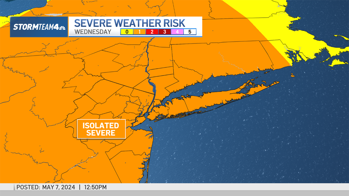
A strong cold front is pushing through parts of the tri-state region Wednesday afternoon, and some areas can expect wind gusts up to 55 miles per hour as it passes by.
The severe weather threat was initially north of our area, but expanded Wednesday afternoon to include parts of the Hudson Valley. Severe thunderstorm warnings were issued for much of southwestern Connecticut and the lower Hudson Valley; they expired at 6:15 p.m.
Wind advisories are in effect throughout the region as well. (Click here for the latest severe weather alerts.)
As of early Wednesday evening, it looked like Fairfield County got the brunt of the severe weather, with downed trees and wires reported in several towns.
Storm Team 4 expects a significant drop in temperatures behind the front, with lows in the 40s and 50s around the region by Thursday morning.
See the latest radar images from StormTracker 4 below.