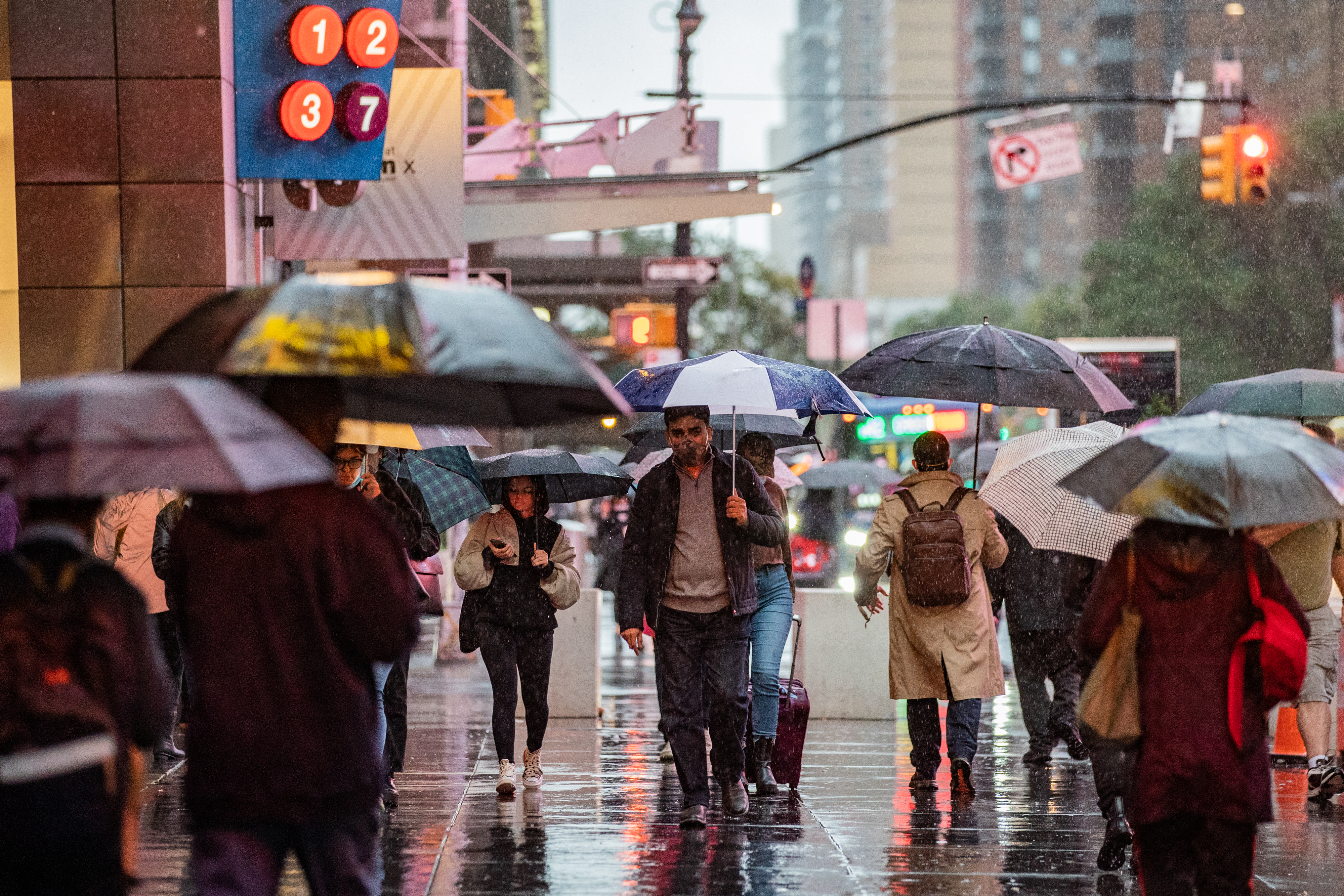
A stormy afternoon doused the region in heavy rains on the eve of some of the hottest weather of the year so far arrives in the tri-state — and the first potential heat wave of the summer will stick around into the weekend.
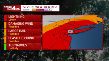
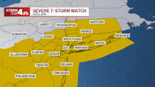
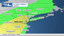
Tuesday's storms sprang up in the early afternoon and showered much of the area throughout the evening commute. The rolling storms triggered a handful of severe weather and flash flood warnings for several counties feeling the fury of the afternoon system.
Check the latest weather alerts for your neighborhood here.
The storms proved especially destructive in at least one neighborhood of NYC. The National Weather Service eventually determined that a microburst blasted Brooklyn's Bensonhurt neighborhood, where multiple trees were uprooted and fell onto electrical wires.
Get Tri-state area news and weather forecasts to your inbox. Sign up for NBC New York newsletters.
Cars parked along Bay Ridge Parkway had broken windows and dented roofs from countless trees, some several stories tall, that were knocked down like dominoes by winds estimated between 60 and 70 mph. Some trees fell on homes and crashed through windows, trapping those inside.
"This huge burst of wind like I never saw came down the street. I looked up and this tree was bending in half, the awning was hanging. It was very scary for a minute," said Joan McGrath.

NYC's Office of Emergency Management Commissioner Zach Iscol said the wild weather is more evidence of climate change.
Weather Stories
"As we reach this new normal, the city is doing a lot of things to make sure we are prepare to make sure we’re doing all we can to protect New Yorkers," said Iscol.
The winds and rain impacted power across New Jersey and New York, where utility companies reported outages to a few thousand customers Tuesday evening.
Storms had mostly cleared NYC before 6 p.m., and were projected to finish with the rest of the tri-state another two hours later.
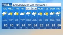
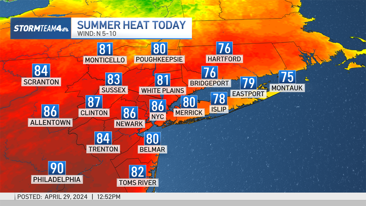
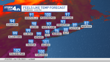
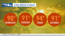
Then the heat arrives, and it will be very hot for the remainder of the week. Temperatures will top 90 degrees Wednesday, and highs will stay around that level (and above) through Saturday. Friday looks to be the hottest of the stretch, as highs are expected to be around 95.
Heat index levels on Thursday and Friday will likely be in the 95-100 range, even possibly topping 100 on Friday.
Connecticut Gov. Ned Lamont said the state would activate its extreme hot weather protocol during the hot spell, from Wednesday morning to Sunday morning. Cooling centers will be made available statewide.
Highs will peak on Friday and Saturday before a front will cut temperatures 10 to 15 degrees for Sunday and Monday. Temperatures are more seasonable to start next week.
See below Storm Team 4's exclusive 10-day forecast: