
Remember how nice last weekend was, weather-wise? Good. Keep remembering.
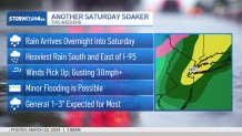
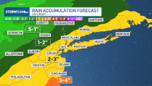
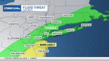
We've got yet another Saturday soaker on tap for the tri-state area this weekend, a storm expected to dump a widespread 1 to 3 inches of water on the region. It starts overnight Friday into Saturday and progressively intensifies.
Rain may be heavy at times, though the heaviest rain will likely be south and east of I-95. Minor flooding is possible. Winds will pick up, too, gusting at 30 mph or higher.
That's not the only bad news.
Get Tri-state area news and weather forecasts to your inbox. Sign up for NBC New York newsletters.
Heavy rainfall stokes flood concerns Saturday
Weather Stories

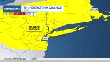
Chance of thunderstorms today
Showers are expected to dampen spots across the metro area Wednesday night. Thunder is possible, too. The rain will be spotty and mostly amount to just nuisance rain, but there could be snow showers for some well north and west of NYC.
Winds will pick up overnight as temperatures plunge, with wind chills expected in the teens and 20s early Thursday. It will usher in two days of much colder air, with overnight into Thursday morning being the coldest period — so jackets will definitely be necessary heading to work and school.
Winds ease in the afternoon, but it won't do much to warm things up.
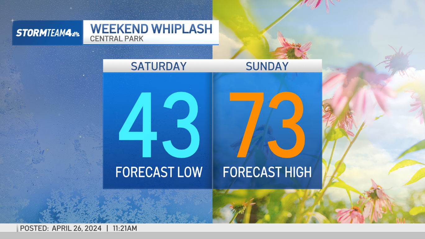
Sunday looks to be the better weekend day at this point, though it will still be mostly cloudy and chilly.
We start to warm up back near average come Monday, and the risk of rain returns later in the week. The Mets could see a damp home opener that has nothing to do with the state of their play.
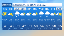
10-day NYC weather forecast
Check out our 10-day New York City weather forecast below.
Track the rain using our interactive radar below and get more from Storm Team 4 here.
