Parts of the tri-state that have already seen multiple inches of rain over the past few weekends — leading to deadly flooding and washed out roads — could get soaked even further Tuesday, as potentially severe storms are set to move through the region.
Storms powerful enough to possibly trigger thunderstorm warnings or flooding could arrive in the late morning or early afternoon, with the greatest risk coming to the mid-Hudson Valley, due to the previous storms that have left the ground there heavily saturated.
Isolated damage from wind and hail is possible as a result of the line of intense storms.


Get Tri-state area news and weather forecasts to your inbox. Sign up for NBC New York newsletters.
Weather Stories
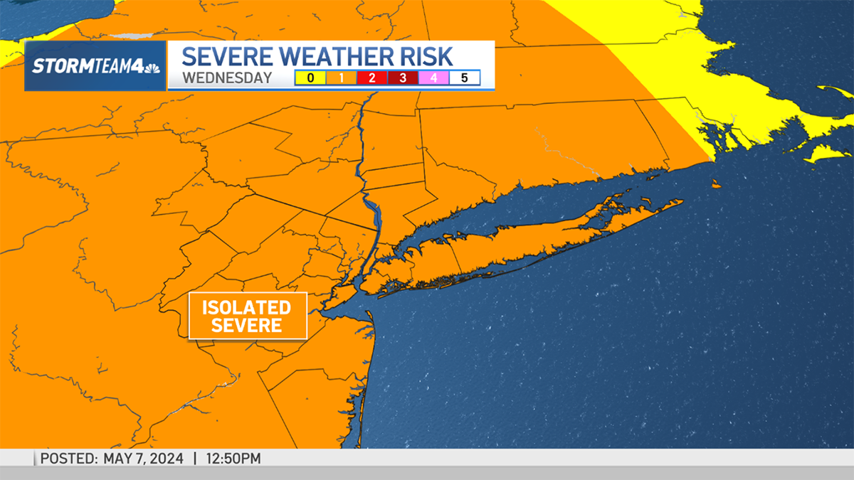
The highest chance for flooding expands from the Hudson Valley to New York City, northeastern New Jersey and onto Long Island. The biggest threats from the severe weather are damaging wind and hail for the entire region.
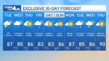
The forecast could remain wet for Wednesday as well, as more showers and thunderstorms could bubble up again midday amid another day of heat and intense humidity. Mercifully, that humidity is expected finally tick down over the weekend, providing a bit of a break even as temperatures will remain in the mid 80s.
It also comes as the Air Quality Index (AQI) levels will be elevated for the second straight day, leading to an air quality alert for the NYC metro area. AQI levels neared 150 on Monday, which would have been in the "hazardous" for everyone. Levels are not expected to reach the same level on Tuesday, but could still lead to potential problems for at-risk populations, such as those with breathing problems.
See below Storm Team 4's exclusive 10-day forecast: