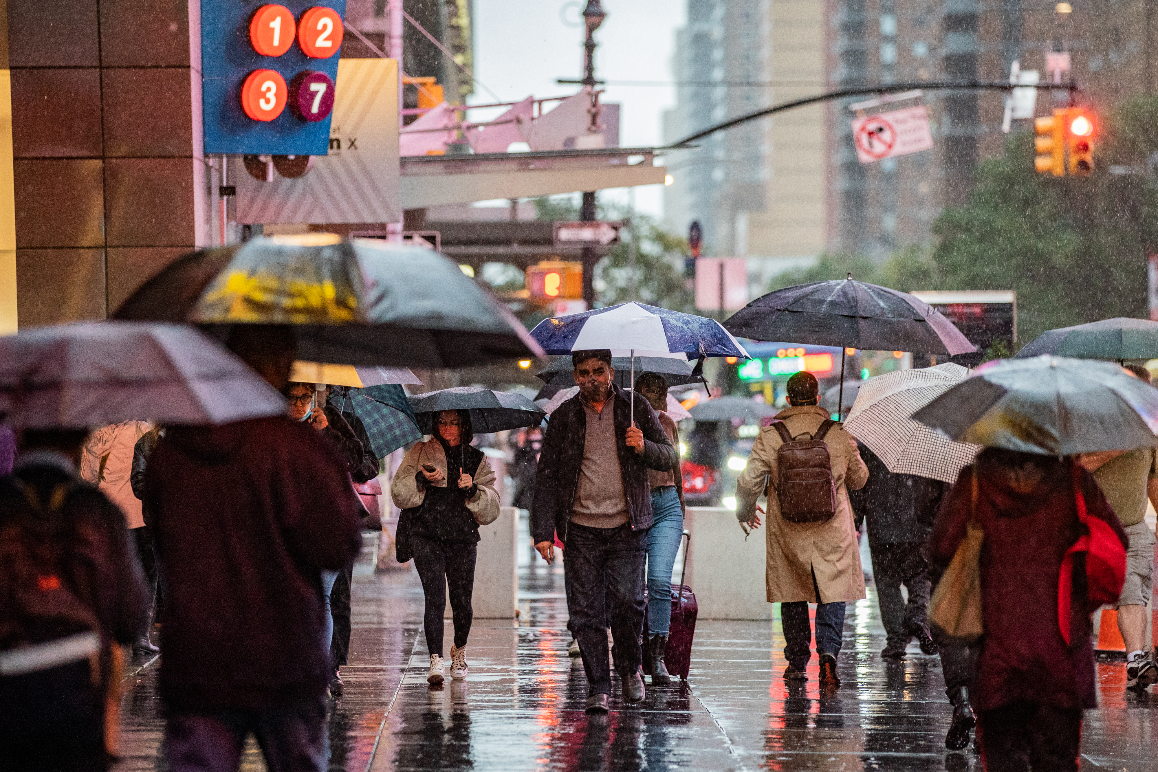
The weekend kicked off with a humid and stormy on Saturday.
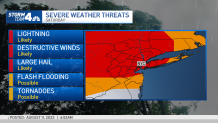
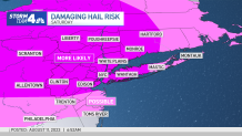
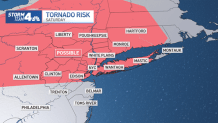
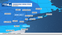
The chance for severe weather returned Saturday afternoon and will last until Sunday morning. At this point, the greatest risk appears to be from damaging winds and hail, though tornadoes can't be ruled out either.
Nearly the entire tri-state area is in the risk area to see lightning, hail, destructive winds, possible tornadoes and even flash flooding. The rain is not expected to be overly heavy at any point, so flooding is not the primary concern, but localized flash flooding is still a threat for some areas with any of the scattered storms that move through.
Severe thunderstorm warnings were issued for Dutchess, Ulster, Orange and Sullivan counties in New York as well as Sussex and Passaic counties in New Jersey and Fairfield County in Connecticut throughout the day Saturday.
Get Tri-state area news and weather forecasts to your inbox. Sign up for NBC New York newsletters.
Ulster county also saw a flash flood warning at one point and even a tornado warning was also initially issued for Sullivan County in New York, which has since expired.
The severe weather threat moving through the tri-state area has also put a damper on area events, including the much-anticipated Lionel Richie and Earth Wind and Fire joint concert scheduled for Madison Square Garden Saturday night.
In a post on X (formerly known as Twitter), Lionel Richie announced that due to the severe weather, he was unable to land in New York and surrounding areas.
Weather Stories
As a precaution for possible severe weather particularly in parts of upstate New York, Gov. Kathy Hochul directed state agencies “to be on high alert now that the National Weather Service has updated the risk level for severe weather in New York, particularly in the Southern Tier and parts of the Western Hudson Valley."
"This could lead to significant thunderstorms, flash flooding, high winds, power loss and potentially even tornadoes. The Division of Homeland Security and Emergency Services is tracking these storms closely and utility crews are standing by to address any power outages," Hochul went on to say in her statement. "It’s critical that New Yorkers in these impacted regions stay vigilant: monitor your local forecast, make sure all electronics are properly charged, and prepare supplies in the unlikely event an evacuation is needed.”
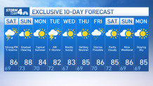
That's not to say the weekend will be a washout, however. Saturday morning will be clear before the storms arrive, and then skies clear out a bit on Sunday after the system moves one. And any lingering storms Sunday morning should favor the Hudson Valley and Connecticut, so most will be completely dry for that day — though it will stay warm and muggy. So, rest assured, anyone in the area with plans to participate in the New York City Dominican Day Parade will most likely enjoy clear skies and warm temperatures.
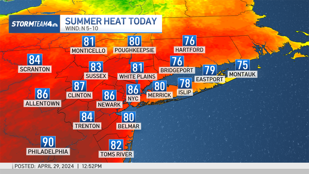
We won't have to wait long for the next round of showers and storms, as those look to arrive Monday evening into Tuesday morning. But the good news: After that, the weather looks fairly pleasant for the remainder of next week. Highs will be very seasonable, in the mid 80s, with plenty of sunshine through the weekend.
See Storm Team 4's exclusive 10-day forecast below: