
Severe thunderstorms walloped parts of New Jersey on Saturday dropping several inches of water within a matter of hours, leaving dozens of people trapped. NBC New York’s Anjali Hemphill reports.
What to Know
- Sweeping thunderstorms dropped more than 5 inches of rain in parts of New Jersey and triggered several tornado warnings throughout Saturday
- Storm conditions canceled Saturday's Monster Jam event at MetLife Stadium, the arena's first 100% event since COVID-19
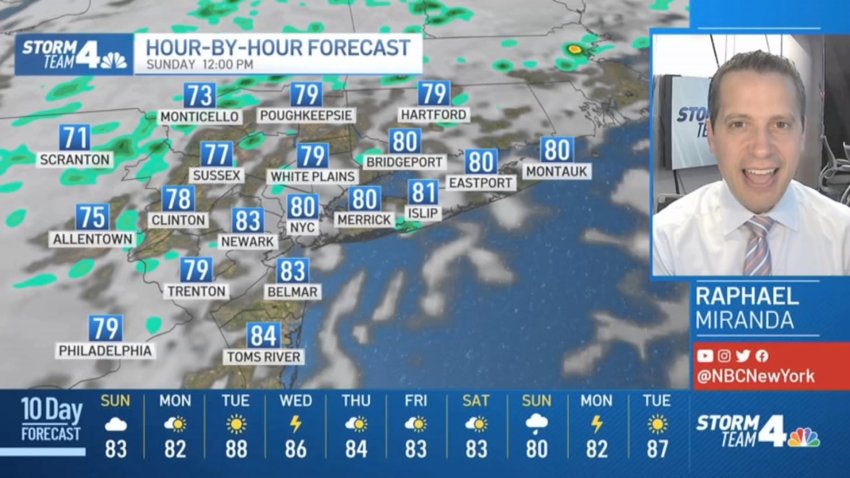
- Temperatures should ease up -- a little -- on Sunday, with less storm risk overall
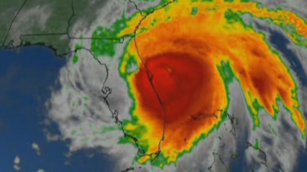
Severe storms rolled through the tri-state Saturday, triggering tornado and flash flood warnings on and off for much of the day. A late round of storms socked the region, but things should cool off (a bit) Sunday, with less storm risk.
Five separate tornado warnings were issued throughout the day for Hunterdon, Middlesex, Monmouth and Ocean counties in New Jersey as well as in Staten Island. No tornadoes were confirmed Saturday but a funnel cloud was spotted in Woodbridge that did not appear to touch the ground.
Watch NBC 4 free wherever you are
Much of west and east-central New Jersey were under severe thunderstorm warnings at various points Saturday night as storms continued to move throughout the tri-state. Ground stops also brought traffic at area airports to a standstill for several hours.
Get Tri-state area news delivered to your inbox with NBC New York's News Headlines newsletter.
The National Weather Service had warned of 60 mph wind gusts and quarter-size hail. In addition to the potential of damaging wind gusts, several counties in the line of the storm were in danger of flash flooding on-and-off into the evening hours.
Weather Stories

Newark was hit especially hard around 3 p.m. with gusts close to 60 mph and several reports of flash flooding. The city recorded more than two inches of rainfall within two hours and promptly issued a traffic advisory to avoid several dozen roads for flooding or flooding potential.
Check the latest severe weather alerts for your neighborhood here.
Reports of downed trees and flooded streets came in from all across New Jersey. Newark Liberty Airport experienced delays due to the storm and had to close one of its parking lots for flooding. JFK Airport also reported flight disruptions as the storm moved closer to the city.
Though the worst heat will be in the rearview by the time Sunday arrives, conditions will still stay rather sticky for a few more days before any semblance of relief arrives later next week.
Heat advisories and air quality alerts remain in effect for a large swath of the tri-state area through Saturday evening. Check the latest severe weather alerts for your neighborhood here.
The humidity will stick around through the early part of next week, with more thunderstorms possible Monday as high temperatures fall to the low 80s.
By Tuesday, we're looking at more average temperatures around 85 and the same holds for Wednesday, though more thunderstorms could hit parts of the tri-state area in the afternoon hours.
So when will we get some real relief? At this point, it looks like Thursday finally features less humidity, with mostly sunny skies and temps around 84 degrees.
Track any approaching storms using our interactive radar below.