From the Great Flood of 1862 to the winter 2017 soaking rains in Northern California, take a look back at some of the state's major floods.
48 photos
1/48
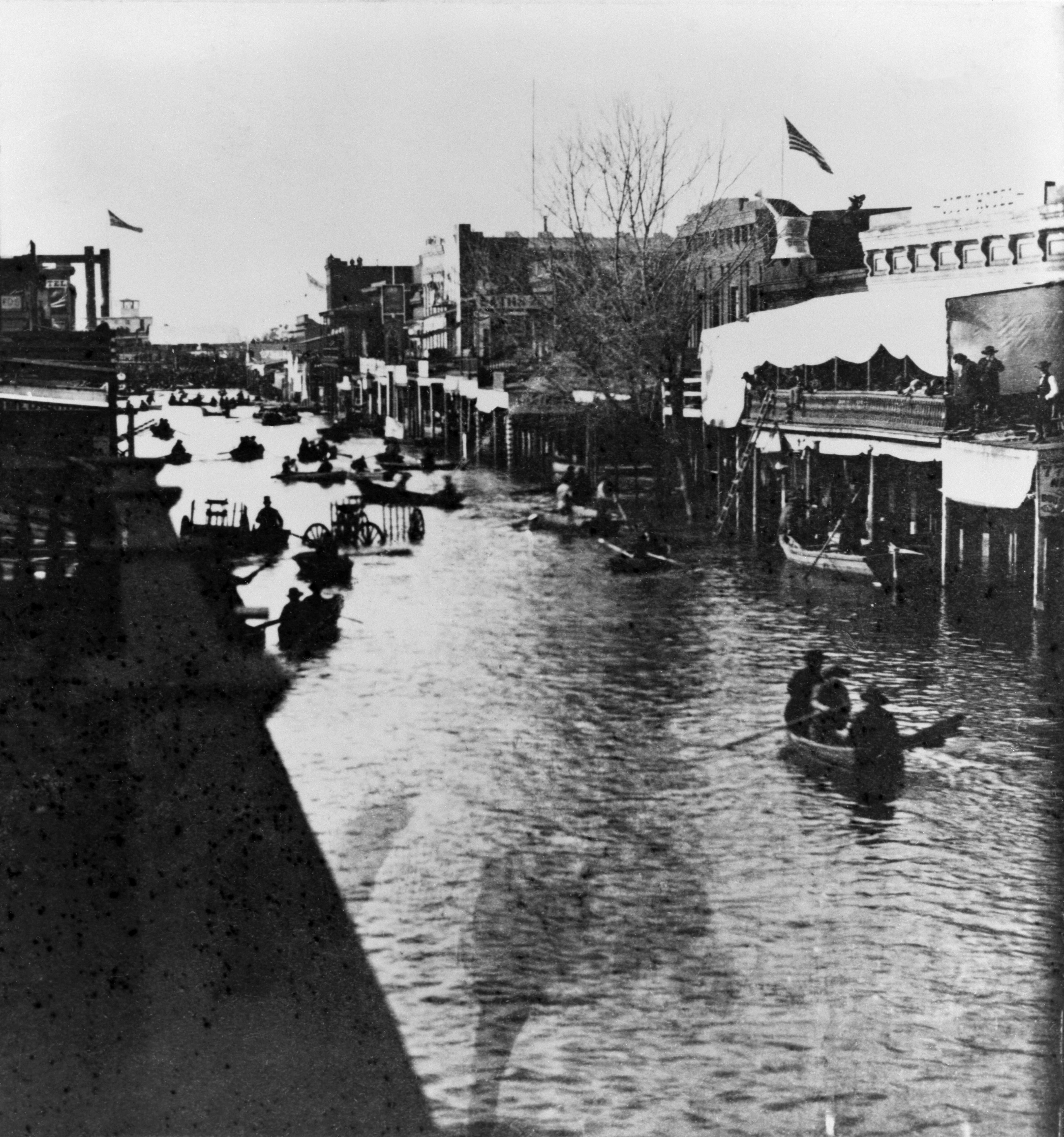
California State Library
The Great California Flood of 1861-1862 was a series of four floods: Dec. 9, 1861; Dec. 23 to 28, 1861; Jan. 9 to 12, 1862 and Jan. 15-17, 1862.The winter rains started early in November and continued nearly uninterrupted for four months. Marysville and Sacramento suffered the worst damage in the Northern California valley. This photo taken January 1862 shows the floodwaters along K Street looking west from 4th Street in Sacramento.
2/48
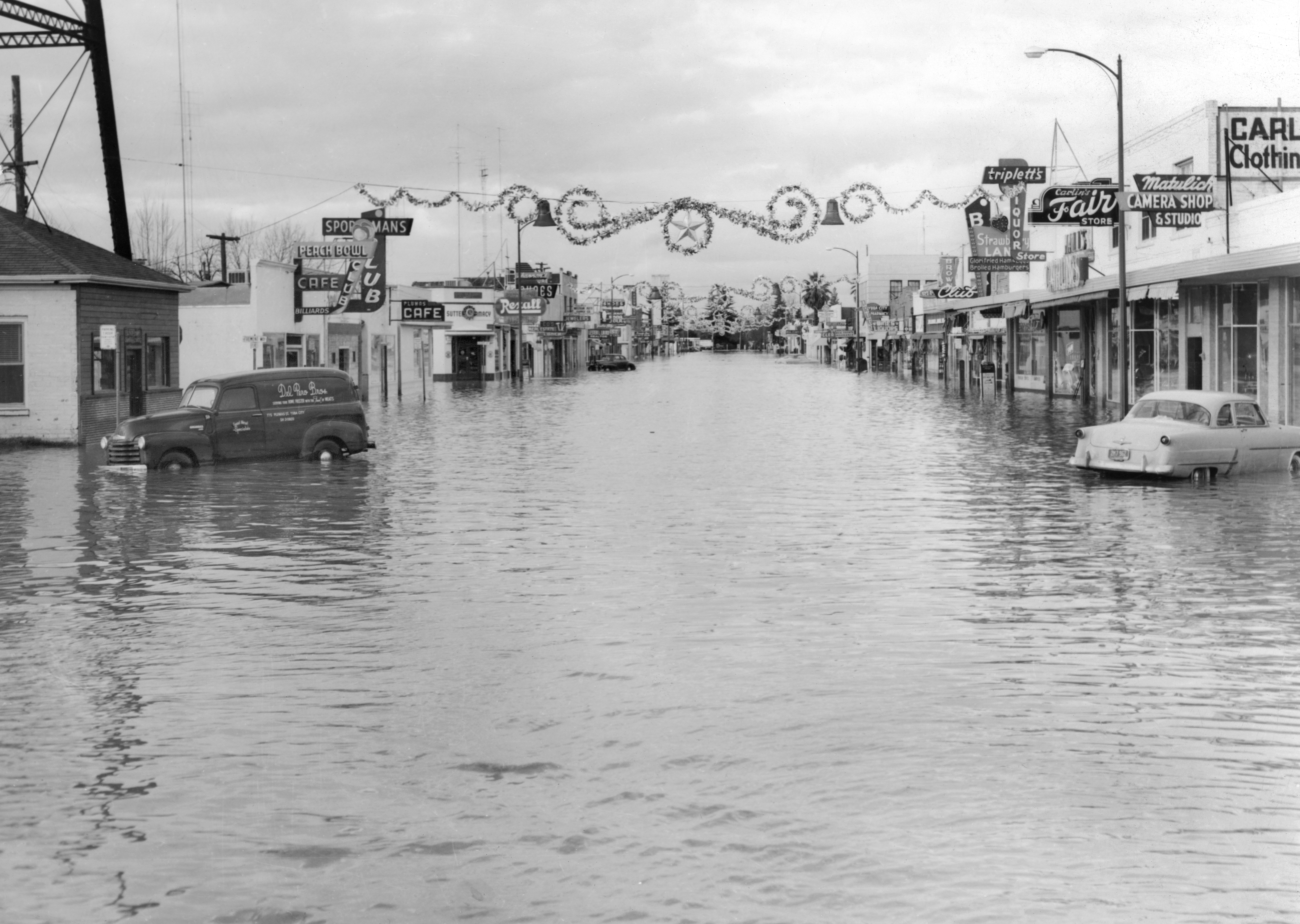
U.S. Force 136th Engineer Aviation Brigade
The massive Northern California flood of 1955 remains the deadliest to hit the Yuba City and Marysville region with 38 killed. Nearly 300 homes were destroyed and more than 1,500 were damaged. The Shanghai Bend on the west levee of the Feather River, about one mile south of Yuba City, was breached around midnight on Christmas Eve. A wall of water cascaded into Sutter County, forcing thousands of residents to evacuate their homes. This view looks north on Plumas Street, just north of Bridge Street in the heart of the Yuba City business district on Dec. 25, 1955.
3/48
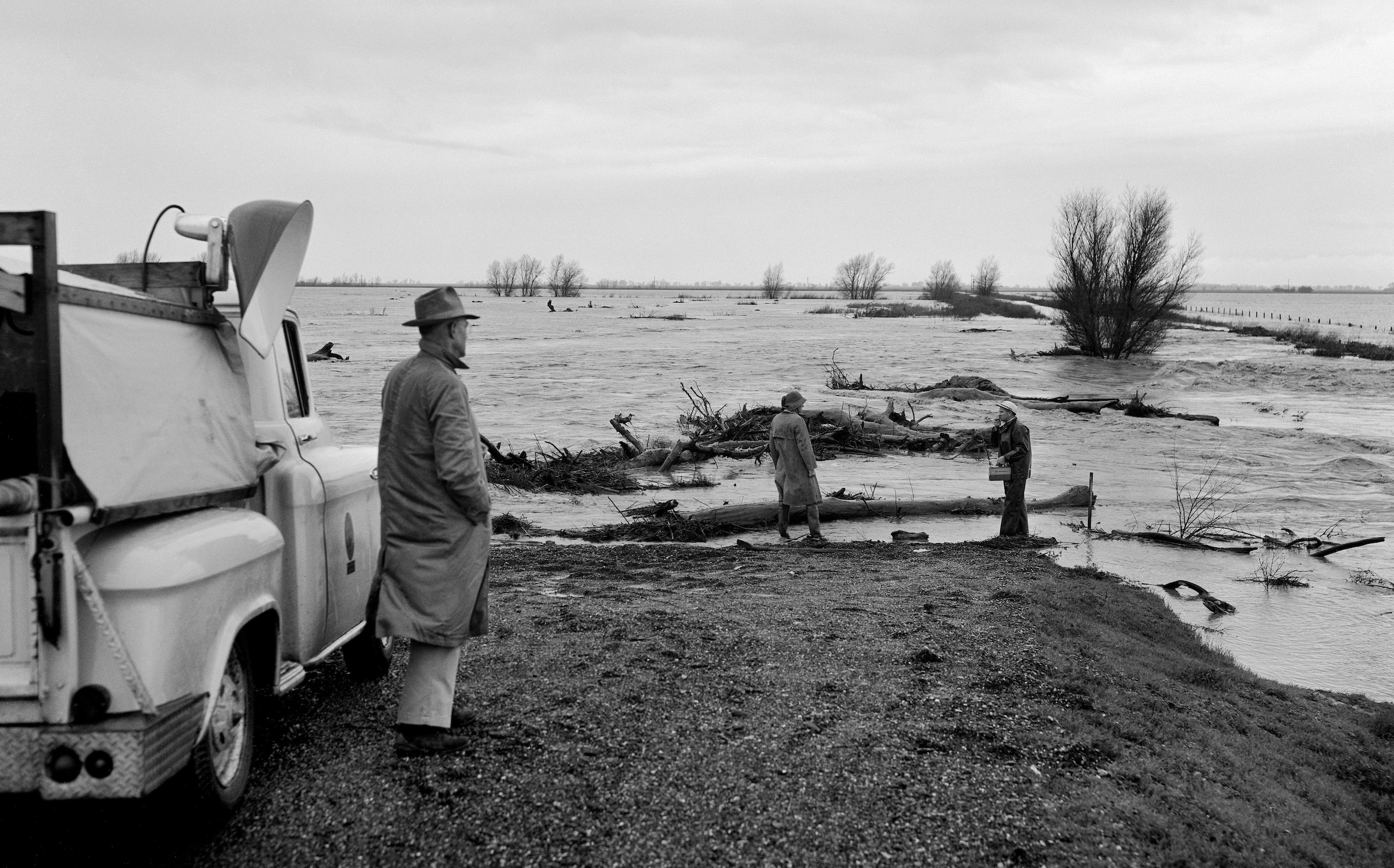
California Department of Water Resources
Floodwater conditions are checked along the south end of the Cache Creek training levee in Yolo County.Photo taken February 19 1958.
4/48
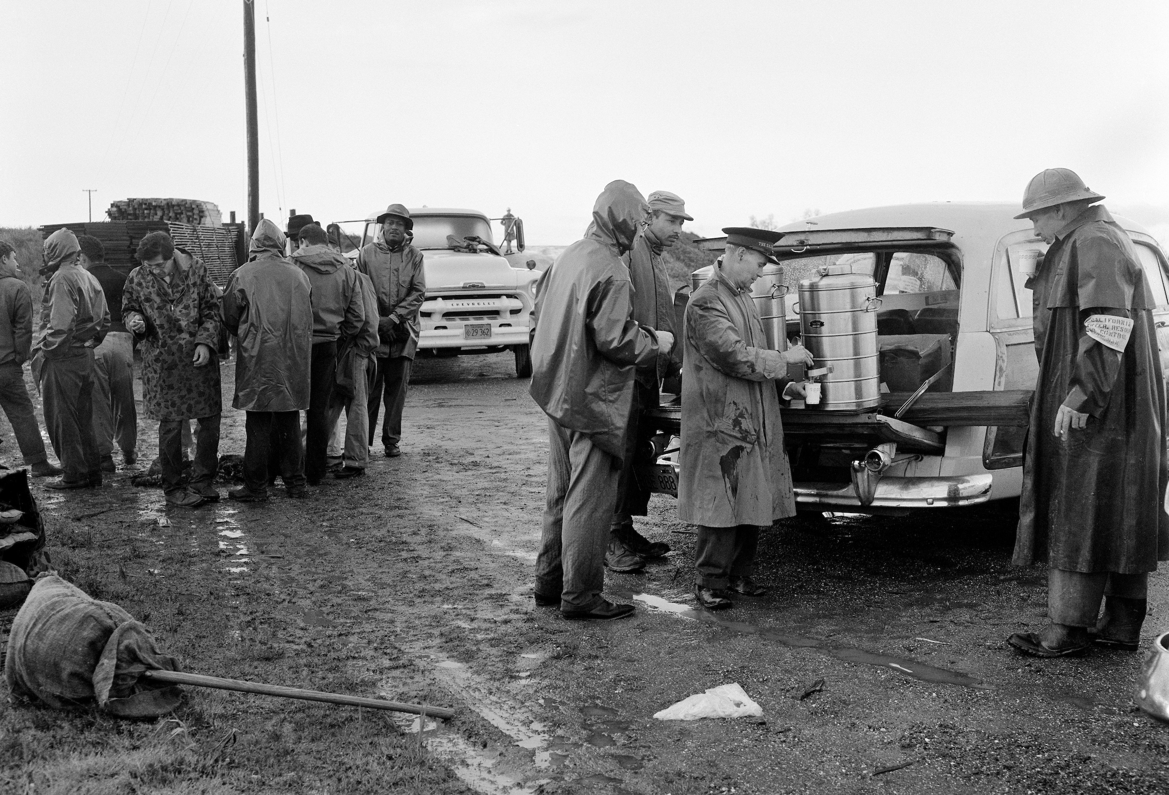
California Department of Water Resources
The Salvation Army provided a warm cup of coffee for the workers and volunteers near the Cache Creek levee during flood conditions near Woodland, California in Yolo County. Photo taken February 25, 1958.
5/48
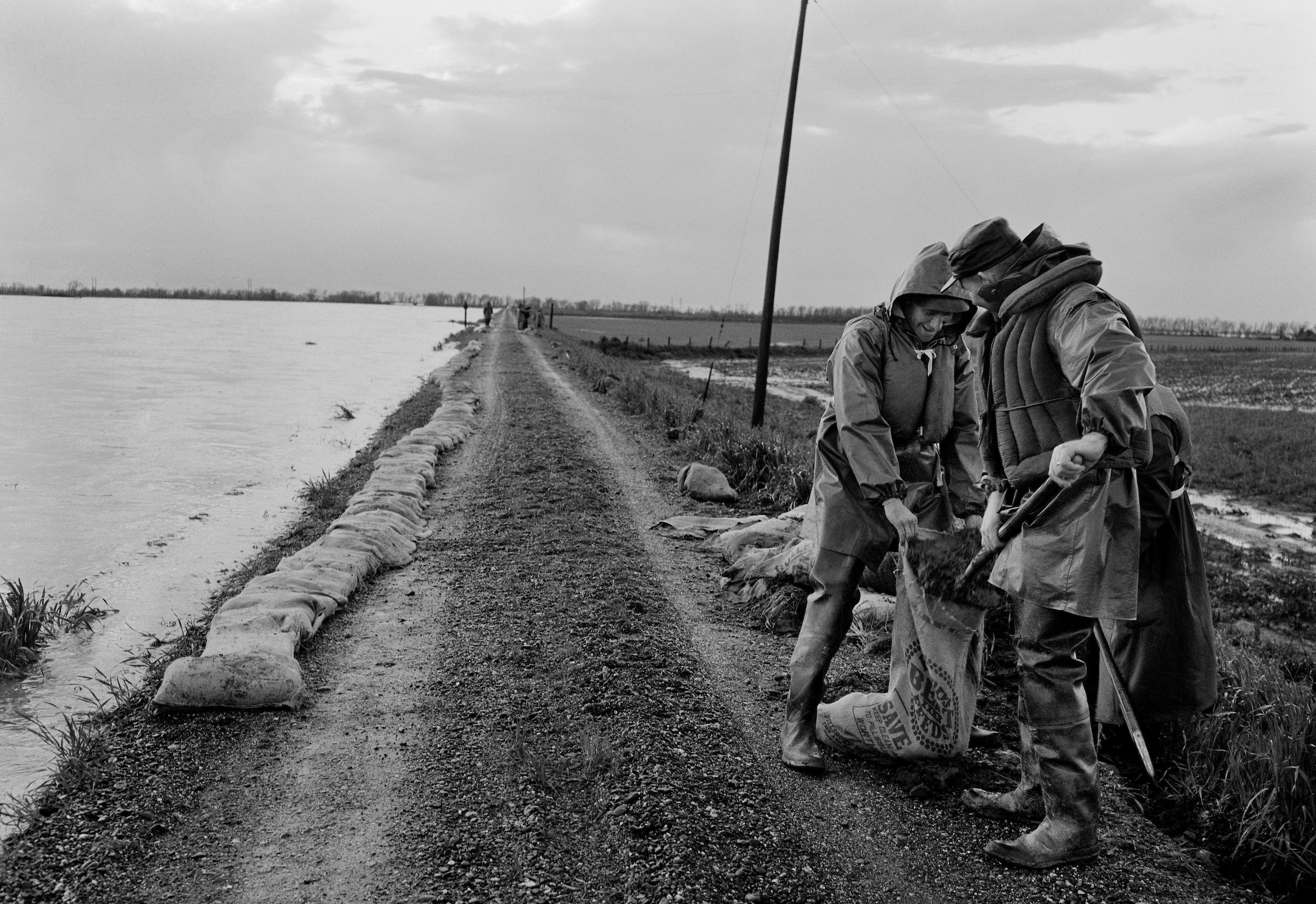
California Department of Water Resources
Two levee patrol members fill sandbags along the Cache Creek training levee near Woodland, California in Yolo County. Photo taken February 25, 1958.
6/48
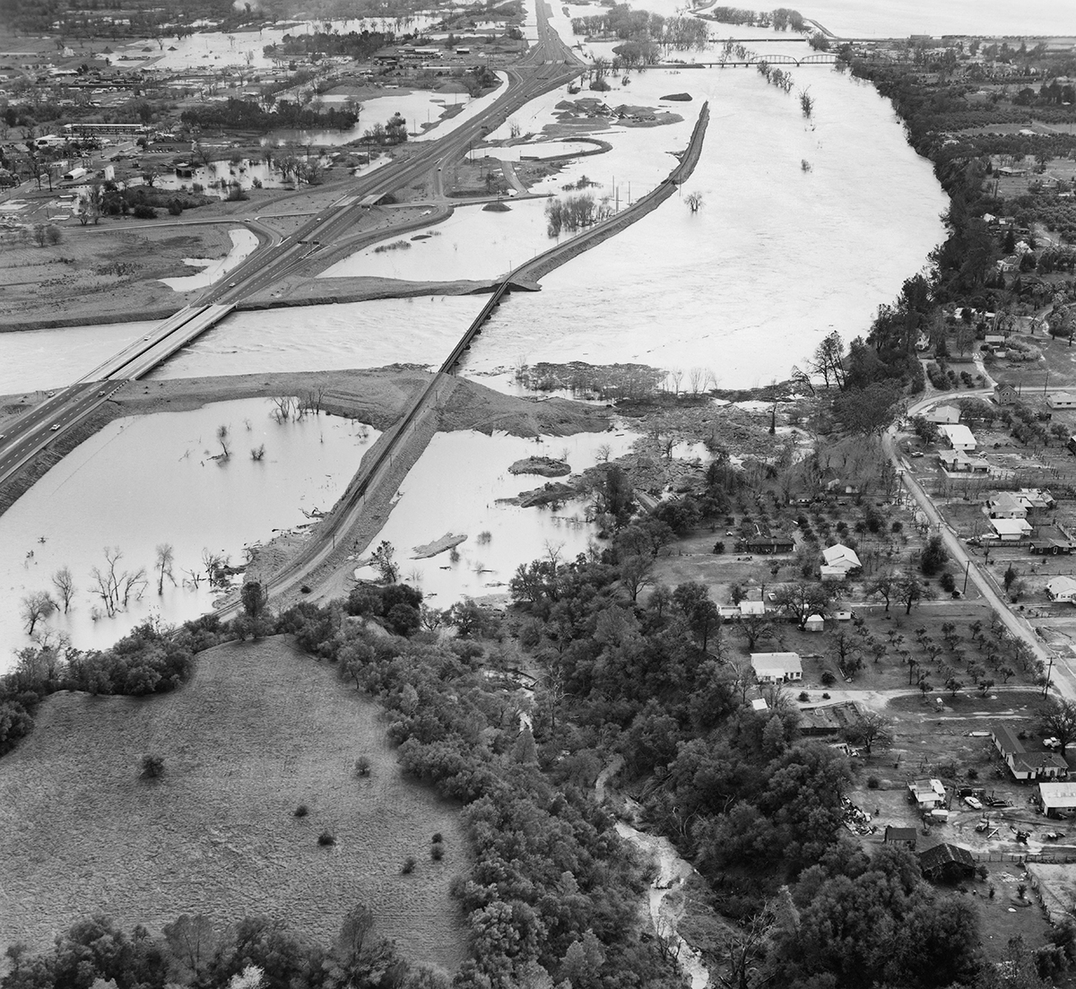
Bob Dunn / California Department of Water Resources
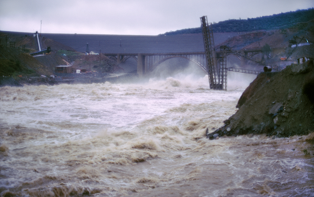
The heaviest rain from the Northern California flood of 1964 occurred on December 22 and 23, hitting the North Coast with gusty winds. The precipitation centered in the basins of the Feather, Yuba and American rivers. This aerial view taken on Dec. 23, 1964 overlooks Highway 70 and the Feather River.
7/48
Bob Mortensen / California Department of Water Resources
Wave wash panels were installed by California inmates on the east bank of the Sacramento River in this photo taken Dec. 24, 1964.
8/48
Bob Mortensen / California Department of Water Resources
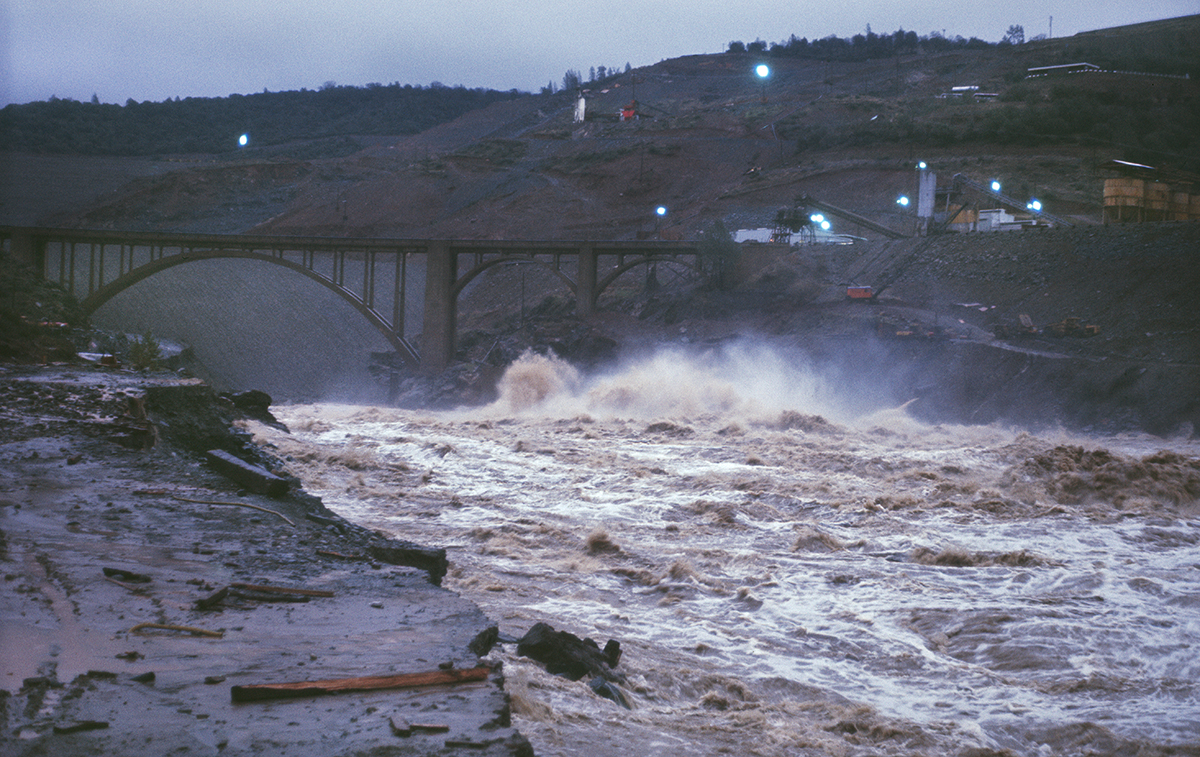
Oroville Dam was still under construction as flood waters from the Feather River tributaries were discharged through the diversion tunnels near the abutment of the Hansell's Bridge in Butte County in this photo taken Dec. 23, 1964.
9/48
California Department of Water Resources
A view of the Oroville Dam embankment, still under construction as flood waters rush from the Feather River tributaries, is seen in this Dec. 23, 1964 photo. The storm hit the North Coast with gusty winds, moving inland with precipitation centered in the basins of the Feather, Yuba and American Rivers.
10/48
Bob Mortensen / California Department of Water Resources
A view of the Oroville Dam embankment, still under construction as flood waters from the Feather River tributaries are discharged through the diversion tunnel in this Dec. 23, 1964 photo.
11/48
Bob Mortensen / California Department of Water Resources
A view of Oroville Dam on Dec. 23, 1964. The dam was still under construction when Northern California floods soaked the region.
12/48
Bob Dunn / California Department of Water Resources
A photo taken Dec. 23, 1964 looks south over Highway 70 and the Feather River that weaves through Oroville and Thermalito in Butte County.
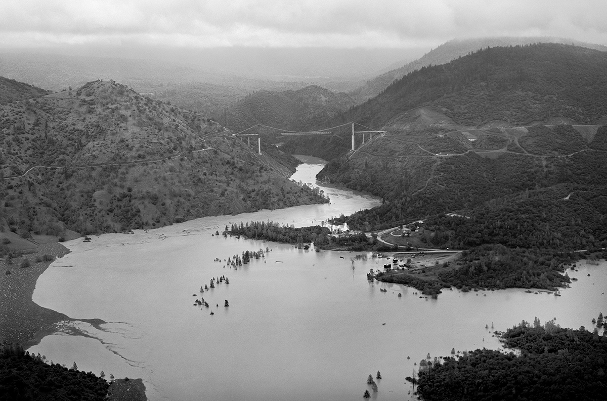
13/48
Vince Arrant / California Department of Water Resources
Flood waters are seen backed up from the semi-completed Oroville damsite, part of the California State Water Project in the foothills of the western slopes of the Sierra Nevada, on Dec. 23, 1964. In the distance is the Bidwell Bar Bridge, a suspension bridge under construction over the Middle Fork Feather River.
14/48
California Department of Water Resources
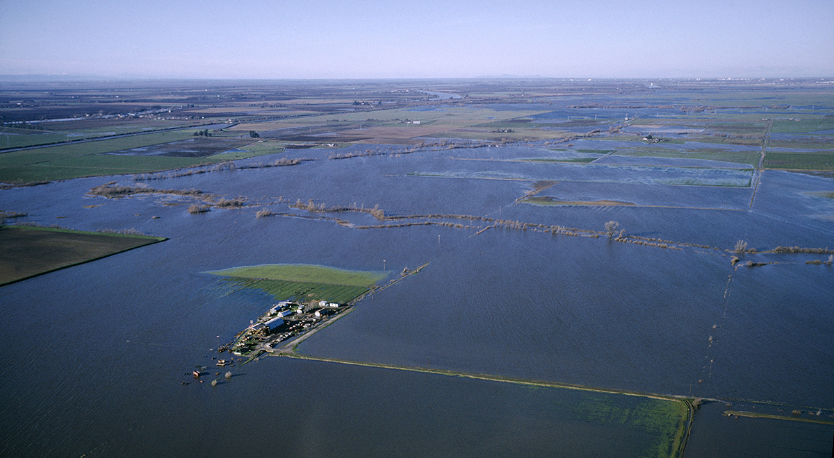
This aerial view taken January 1965 overlooks floodwaters in the agricultural lands of southern Sacramento County near Stone Lake, during the massive Northern California flood of late December 1964 and early January 1965.
15/48
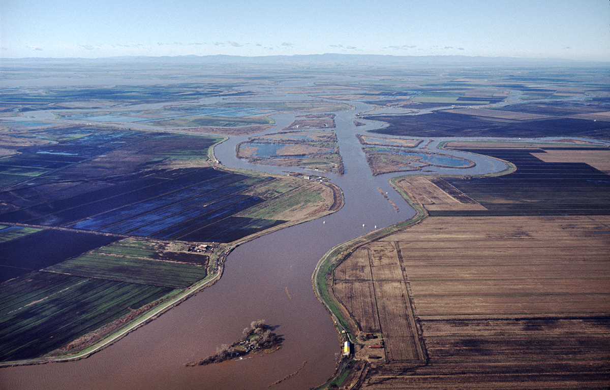
California Department of Water Resources
Floodwaters in the San Joaquin River and a series of small Delta islands in San Joaquin County is seen in this January 1965 photo. A new frontal system brought five more days of precipitation during the first week of January.
16/48
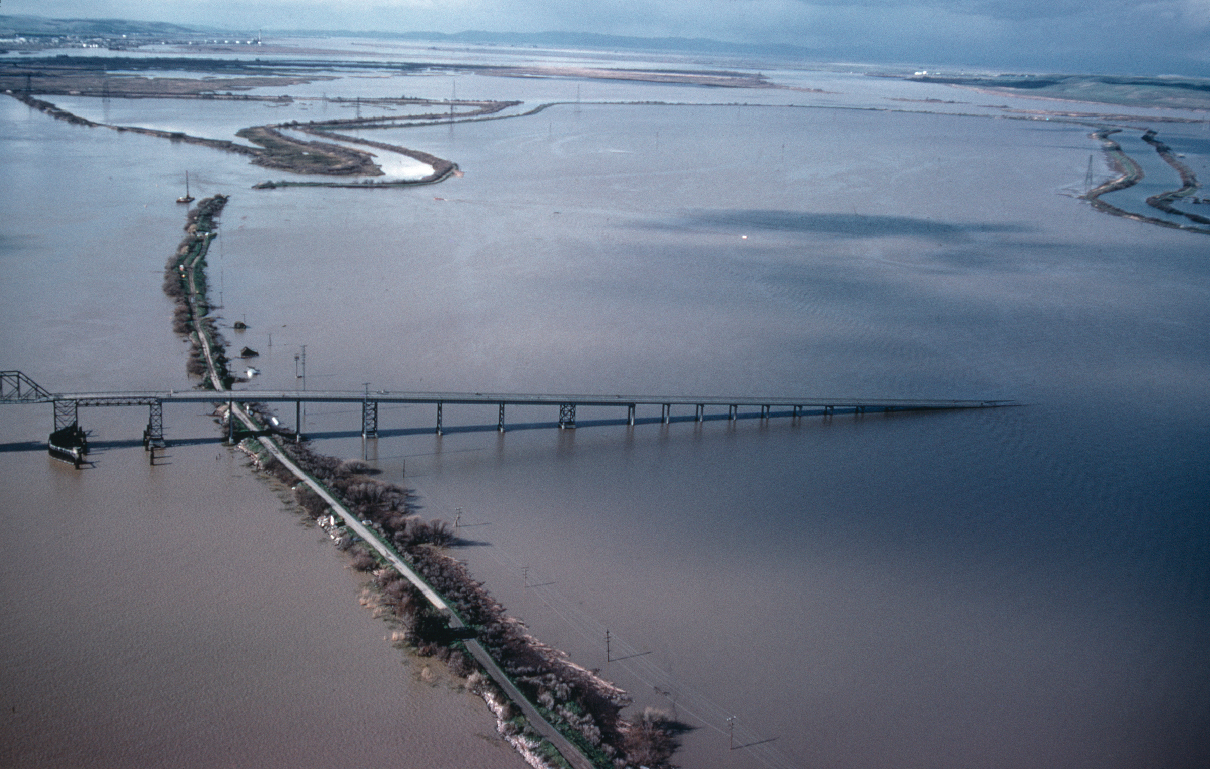
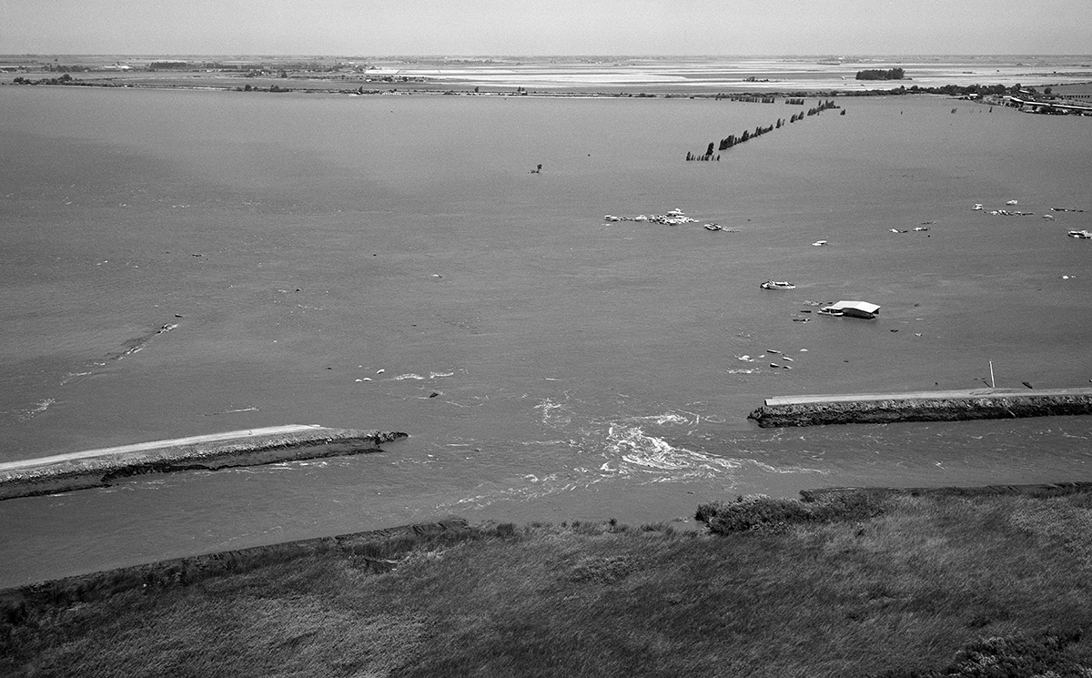
California Department of Water Resources
An aerial view looking west toward the old Antioch Bridge (California Route 160) and the floodwaters that inundated Sherman Island from the breach on the south levee (visible) in the distance along the San Joaquin River in Sacramento County. Photo taken January 21, 1969.
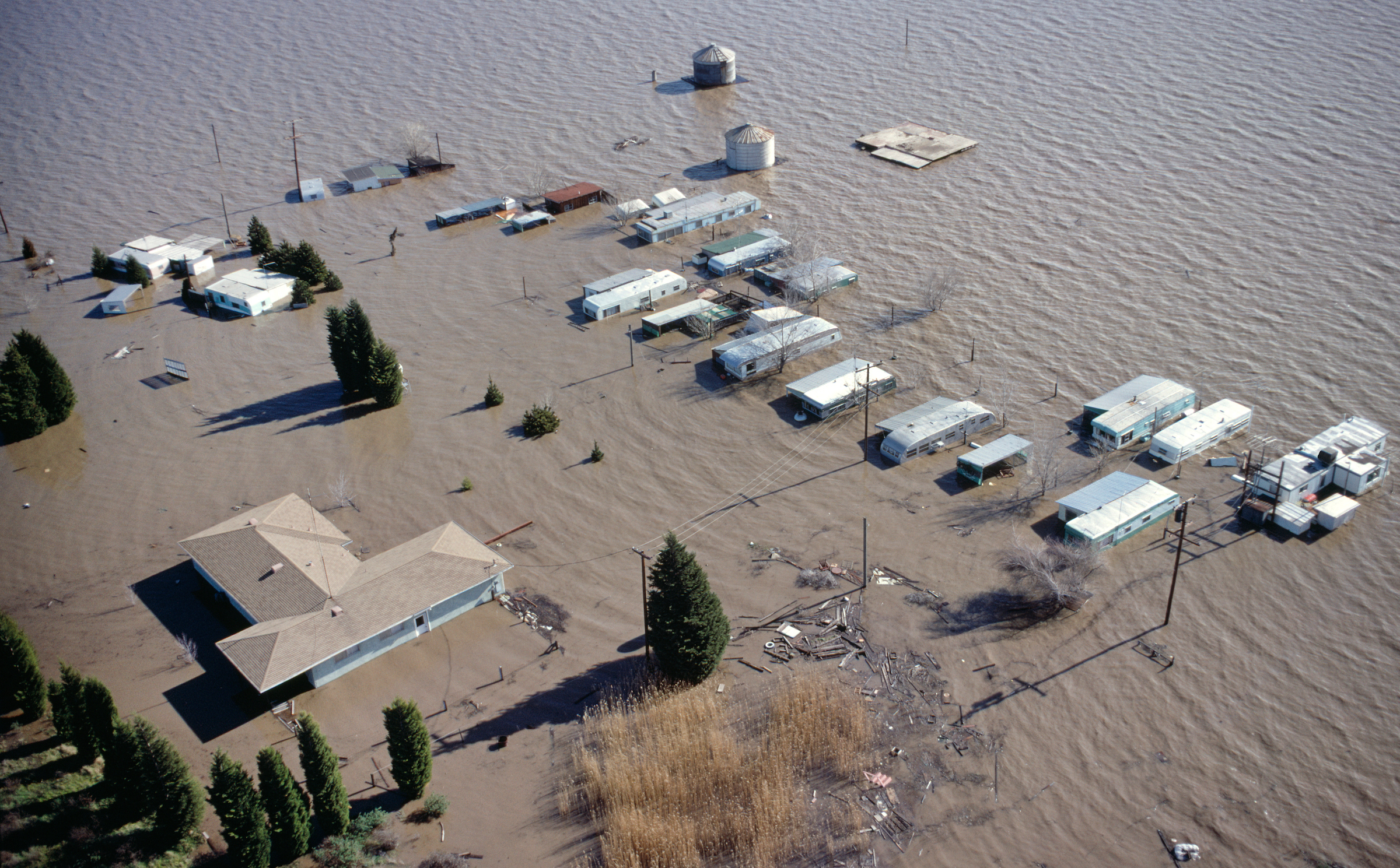
17/48
California Department of Water Resources
An aerial view shows a neighborhood off Leia Drive on Sherman Island inundated with floodwaters after a breach on the south levee along the San Joaquin River near the Antioch Bridge in Sacramento County, California. Photo taken January 21, 1969.
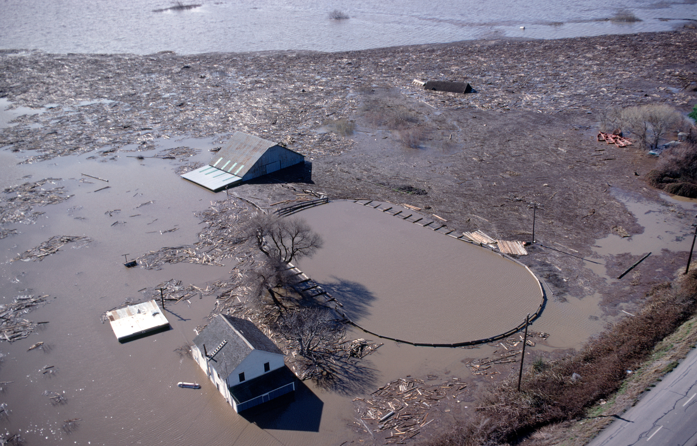
18/48
California Department of Water Resources
Floodwaters surround a farm on Sherman Island from a breach on the south levee along the San Joaquin River in Sacramento County. Photo taken January 21, 1969.
19/48
California Department of Water Resources
An aerial view of the levee breach just west of the old Antioch Bridge (California Route 160) as floodwaters from the San Joaquin River inundated Sherman Island in Sacramento County. Photo taken January 21, 1969.
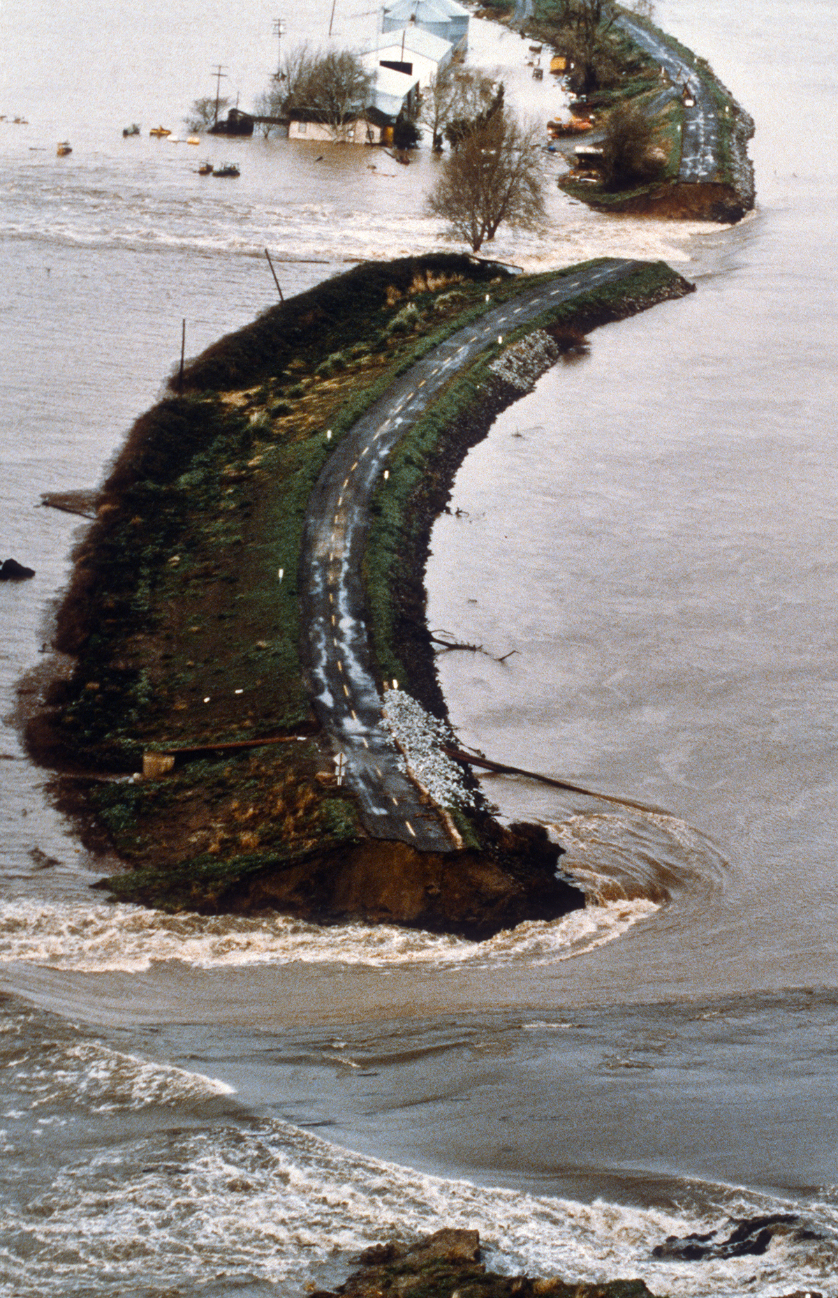
20/48
California Department of Water Resources
A view looking northeast toward the erosion on the land side of the Sherman Island East Levee Road after a beach just west of the Antioch Bridge along the San Joaquin River in Sacramento County, California. Photo taken January 21, 1969.
21/48
California Department of Water Resources
Floodwaters around Sherman Island from this breach on the south levee along the San Joaquin River, just west of the Antioch Bridge in Sacramento County. Photo taken January 21, 1969.
22/48
California Department of Water Resources
Emergency workers survey the flood conditions at an intersection in the community of Isleton, California, after a levee breached four miles to the south in the vicinity of the Spindrift Marina on June 21, 1972. Much of the low-lying region of the Brannan-Andrus Islands was inundated with floodwaters in the Sacramento-San Joaquin Delta.
23/48
California Department of Water Resources
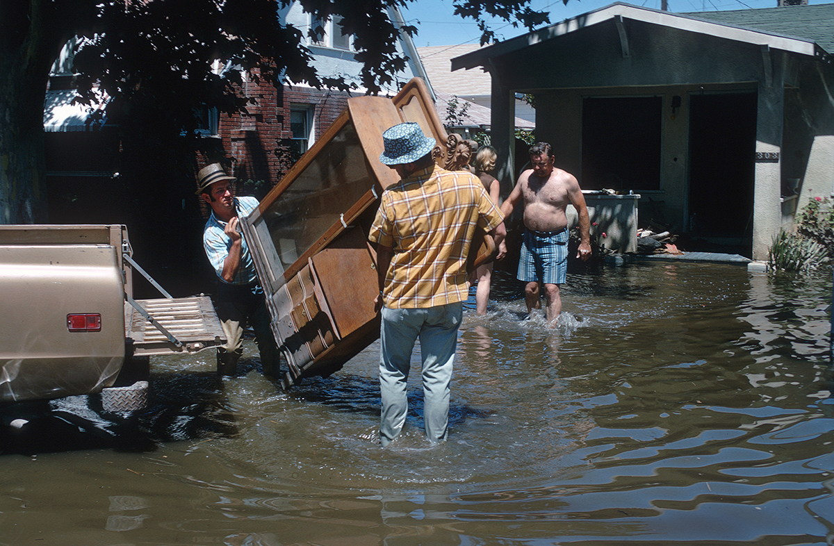
Furniture is removed from a home in Isleton, California, after a levee was breached four miles to the south in the vicinity of the Spindrift Marina on June 21, 1972.
24/48
Ivan Hafstrom / California Department of Water Resources
Highway 12 just east of the Rio Vista Bridge is seen blocked by floodwaters after a levee failed in the vicinity of the Spindrift Marina on June 21, 1972 in the Brannan-Andrus Levee Maintenance District in this photo taken two days after the flood.
25/48
Paul Weber / California Department of Water Resources
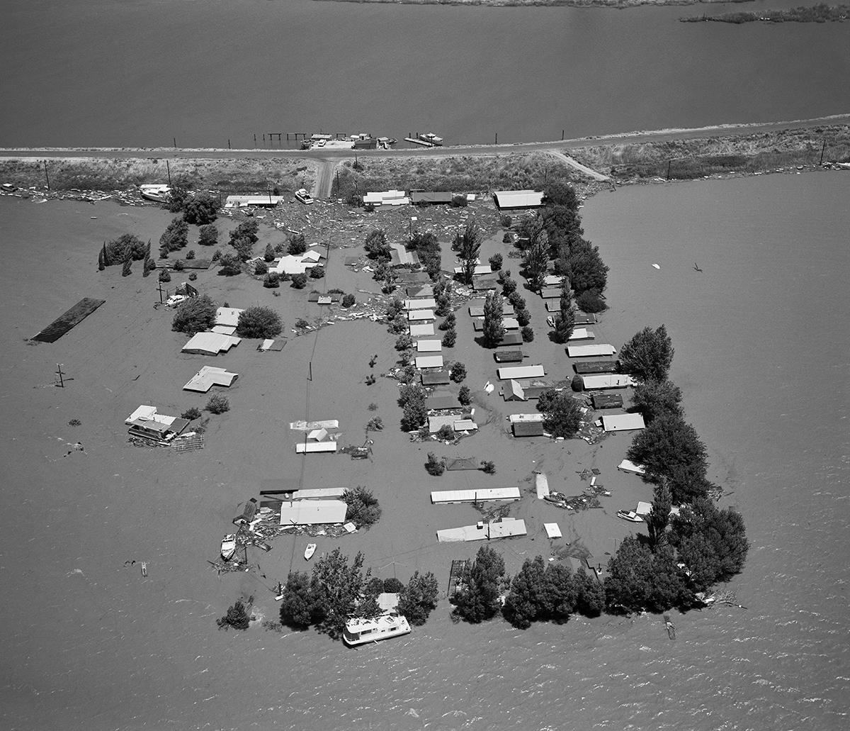
Homes and trailers, at the current site of Delta Shores Marina, off Brannan Island Road and the Mokelumne River levee, is inundated by floodwaters from a levee breach less than a mile away near the Spindrift Marina off the San Joaquin River in this photo taken June 21, 1972. More than 12,000 acres and 35 percent of the town of Isleton within southern Sacramento County were flooded.
26/48
Paul Weber / California Department of Water Resources
A levee breach along the San Joaquin River near the Spindrift Marina is seen in this June 21, 1972 photo. More than 12,000 acres and 35 percent of the town of Isleton was inundated with floodwaters within southern Sacramento County. A Federal Disaster was declared on June 27 within the Brannan-Andrus Levee Maintenance District, with repairs conducted by the U.S. Army Corps of Engineers. The breach was closed on July 26.
27/48
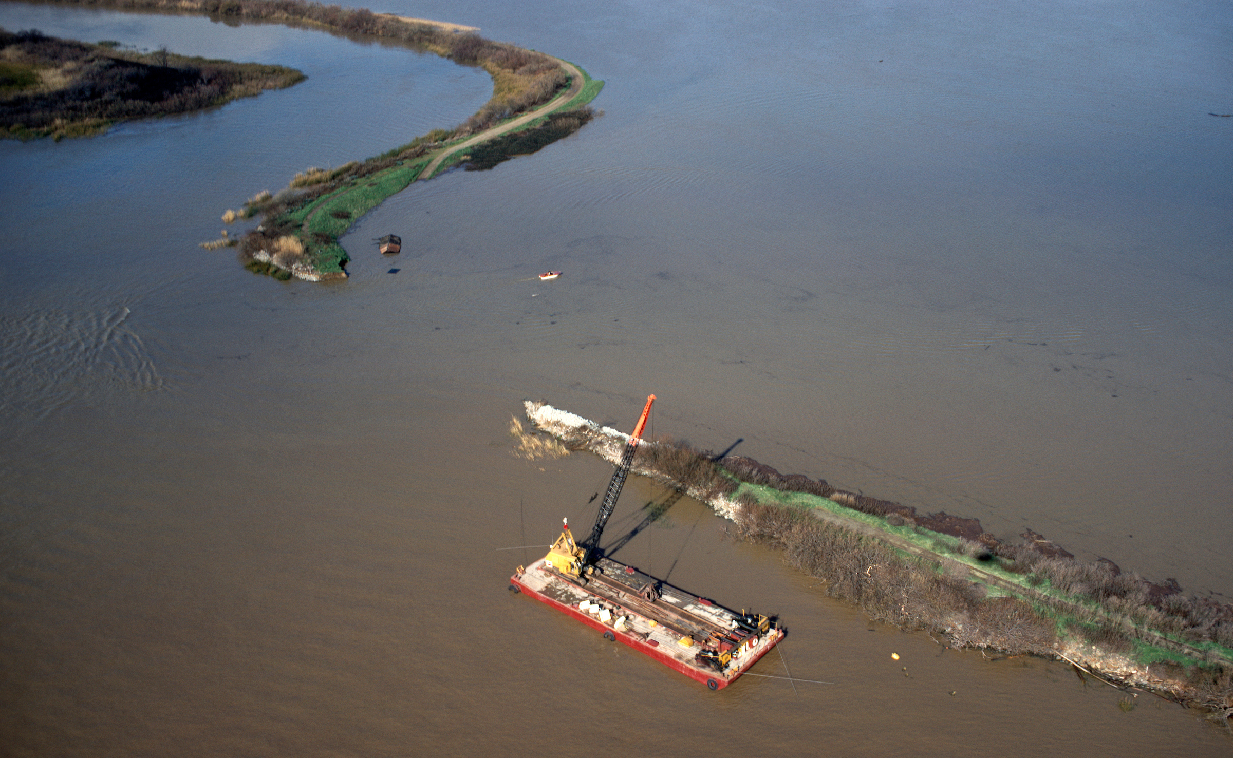
California Department of Water Resources
An aerial view looks south toward a leeve breach on Van Sickle Island in the Sacramento-San Joaquin River Delta. The levee broke in early December 1983 and the state of California declared flooding in nearby Contra Costa County and Reclamation District 2059 a state disaster on December 9. The Pittsburg Generating Station, a natural gas fired facility in the background. Photo taken December 4, 1983.
28/48
California Department of Water Resources
This aerial looks southwest over the floodwaters on Bradford Island, after a 600-foot wide levee break on the island located in Sacramento-San Joaquin River Delta within Contra Costa County, California.Photo taken December 4, 1983.
29/48
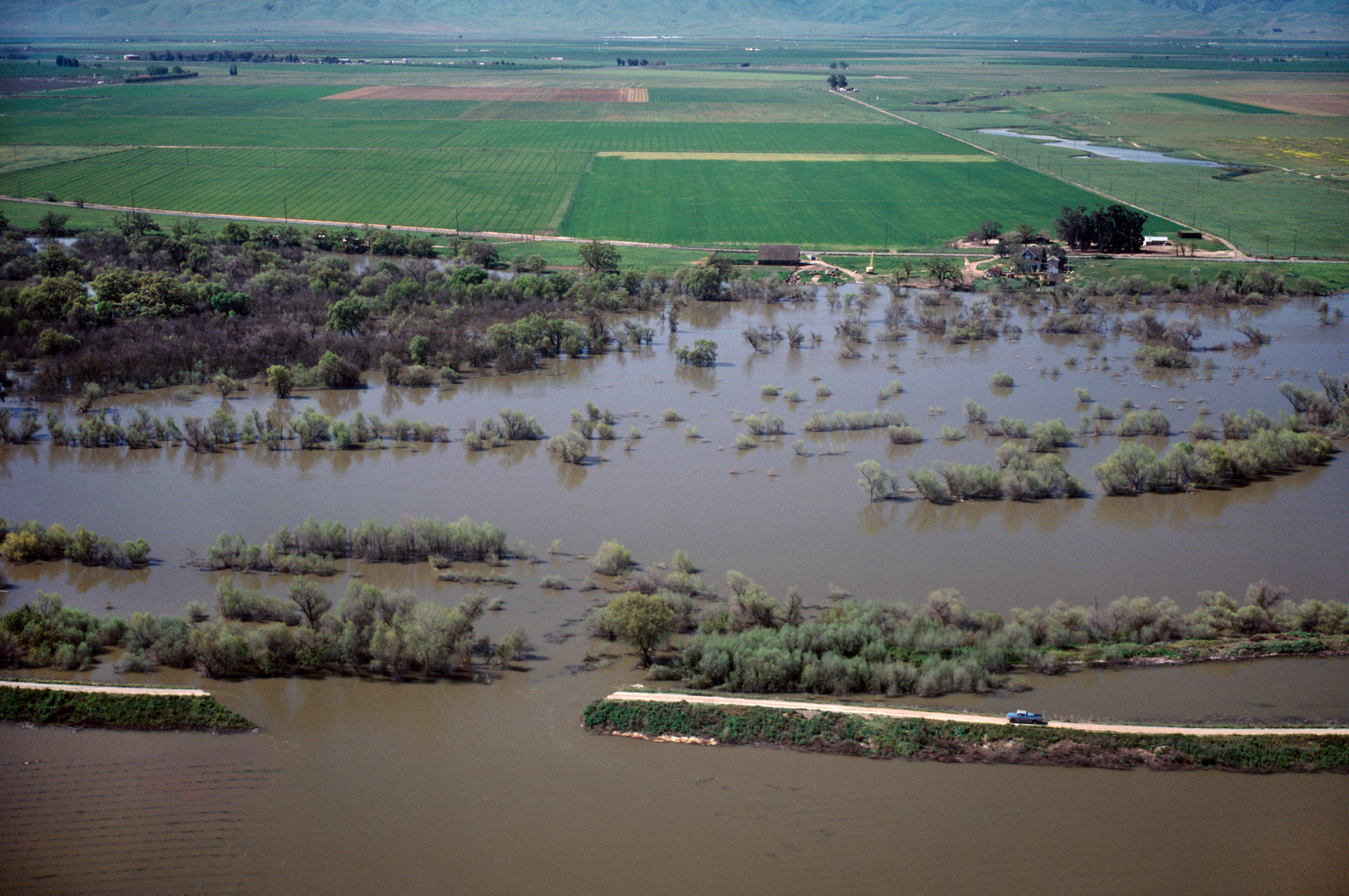
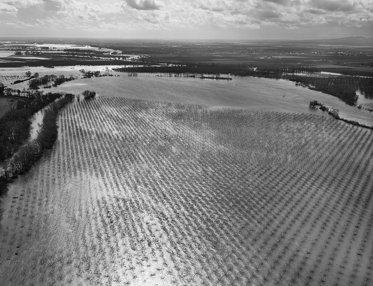
California Department of Water Resources
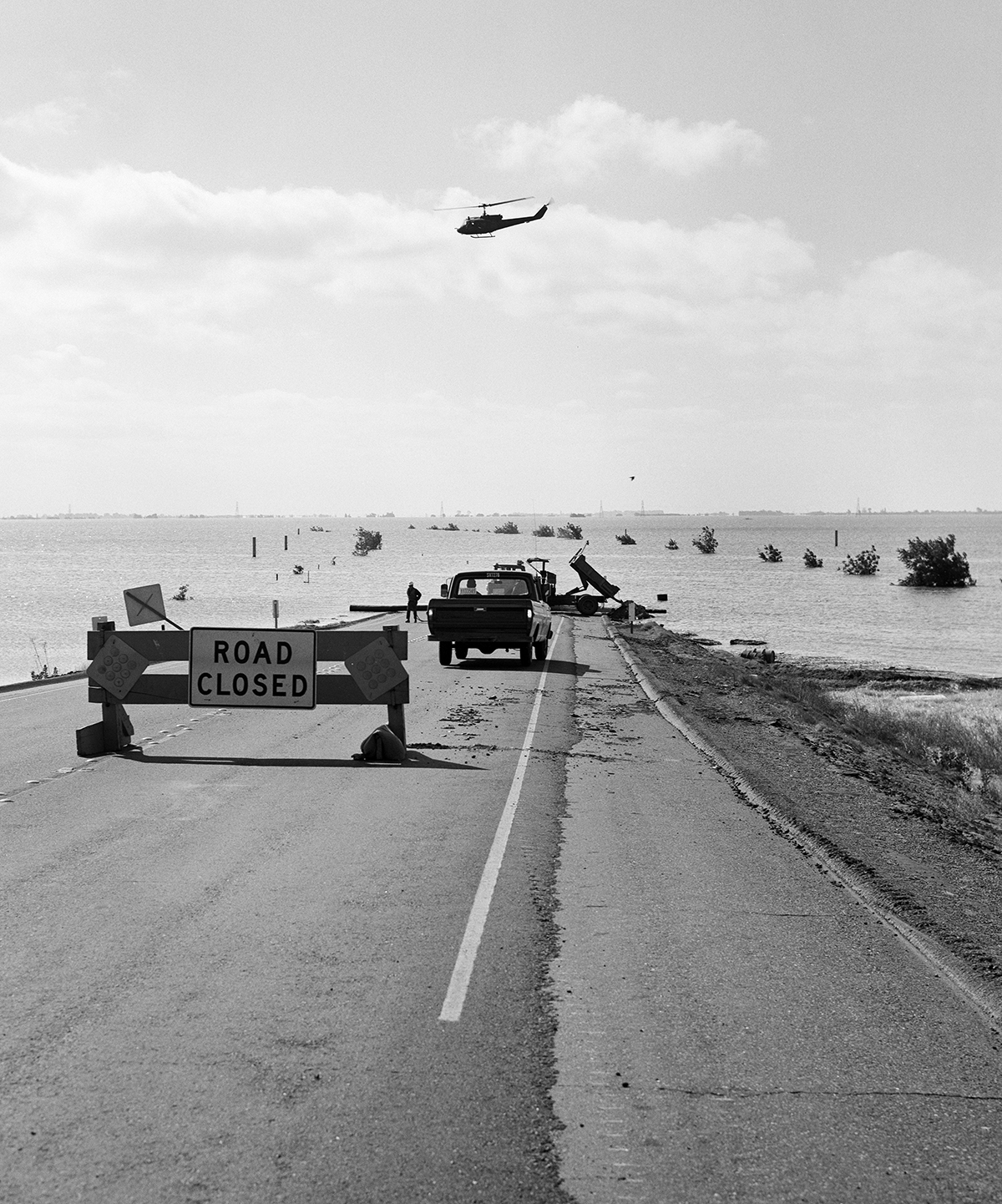
An aerial view looks west over the levee break on Two River Road with waters from the San Joaquin River flooding agricultural lands south of Airport Way and east of South Kasson Road in San Joaquin County, California. Photo taken April 1983.
30/48
California Department of Water Resources
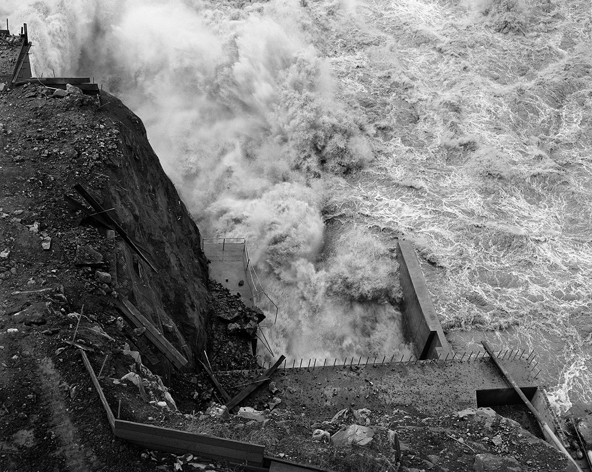
During the Northern California flood of 1986, the Tyler Island levee in the Sacramento-San Joaquin Delta was breached in two spots in this photo taken Feb. 19, 1986. The Sacramento Valley and the Sierra Nevada mountain range received a half-year's precipitation in just 10 days from a series of intense Pacific storms, with the Feather, Yuba and American Rivers receiving the brunt of the rainfall.
31/48
Norm Hughes / California Department of Water Resources
An aerial view is taken Feb. 20, 1986, of flood waters contained within the east and west levees of the Feather River, just east of Live Oak and north of Marysville and Yuba City.
32/48
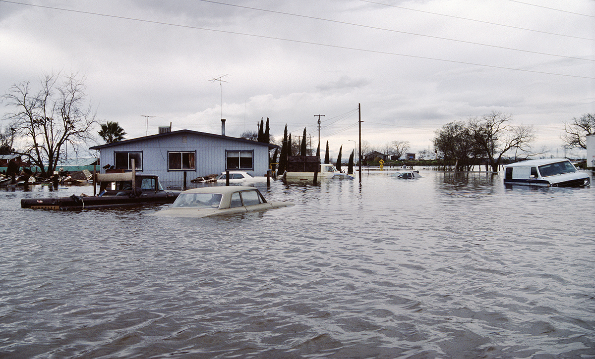
California Department of Water Resources
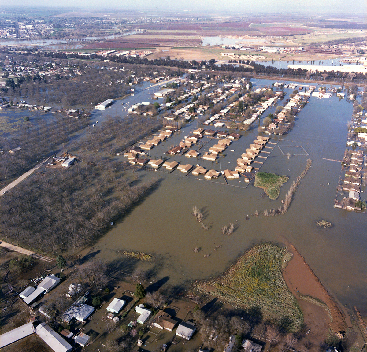
This home on West M Street between Marysville Boulevard and West 6th Street in Rio Linda, Sacramento County was overtaken by floodwaters during the flood of 1986, as seen in this photo taken Feb. 20, 1986. More than 100 structures within Rio Linda sustained damage.
33/48
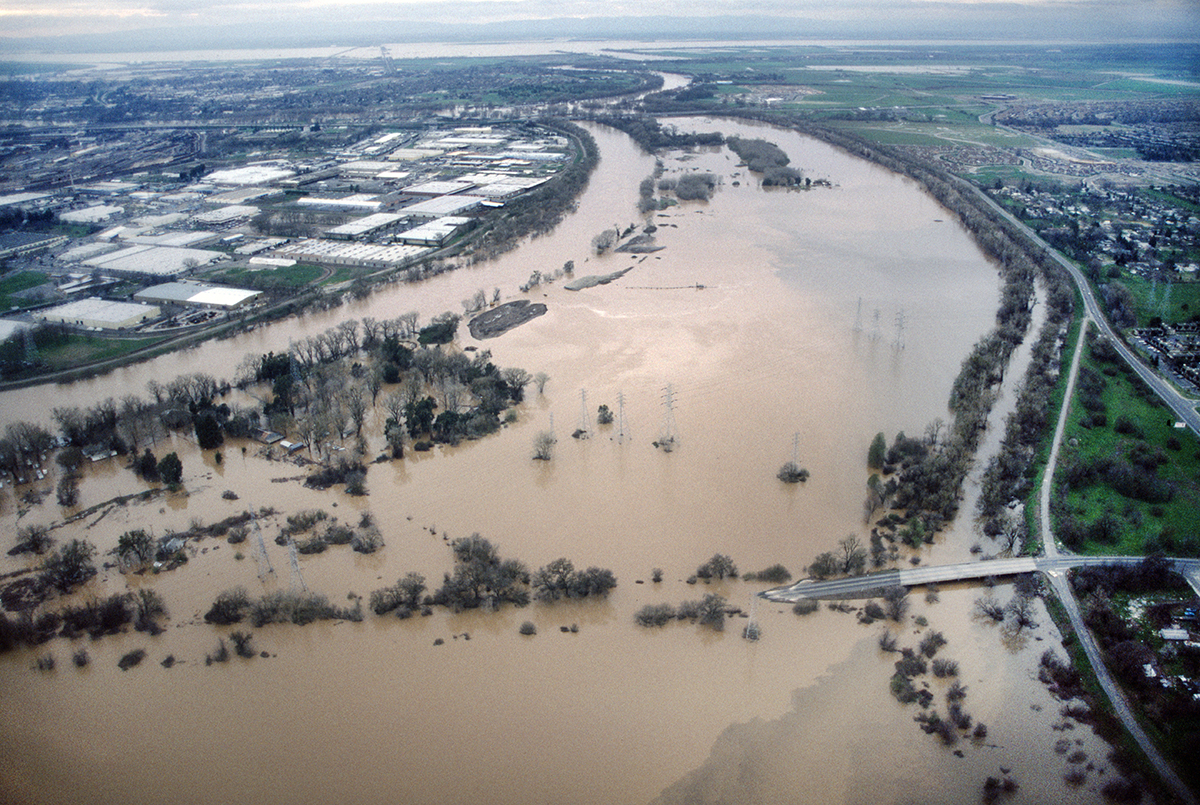
Norm Hughes / California Department of Water Resources
The north and south levees along the American River in Sacramento were put to the test during the Northern California flood of 1986. This photo taken Feb. 23, 1986 looks west over the American River, flooded near Camp Pollock.
34/48
Norm Hughes/California Department of Water Resources
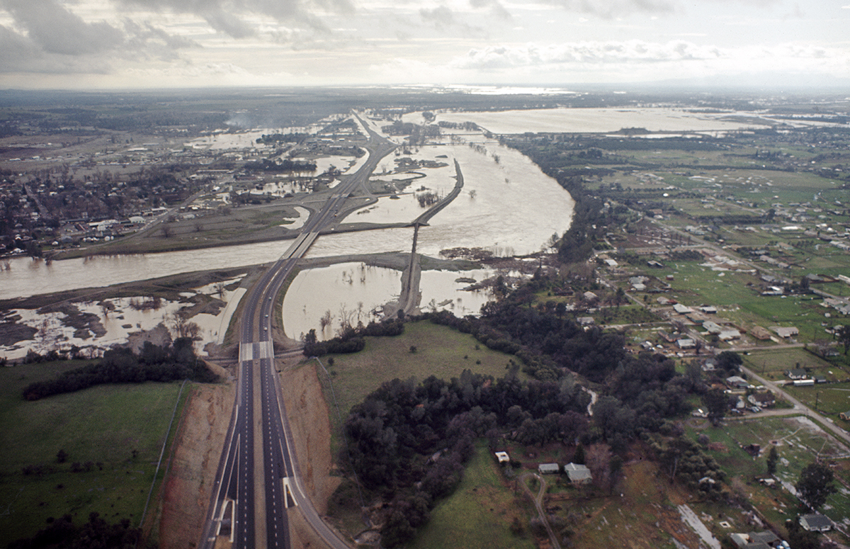
This aerial view taken Feb. 27, 1986, looks northeast over the flooded neighborhood of West Linda in Linda, California and toward Highway 70 near Feather River Blvd. The south levee of the Yuba River in the distance was breached during the massive Northern California flood of 1986, that forced thousands of residents to evacuate their homes in Linda and Olivehurst. The Sacramento Valley and the Sierra Nevada mountain range received a half-year's precipitation in 10 days from a series of intense Pacific storms, with the Feather, Yuba and American Rivers receiving the brunt of the rainfall.
35/48
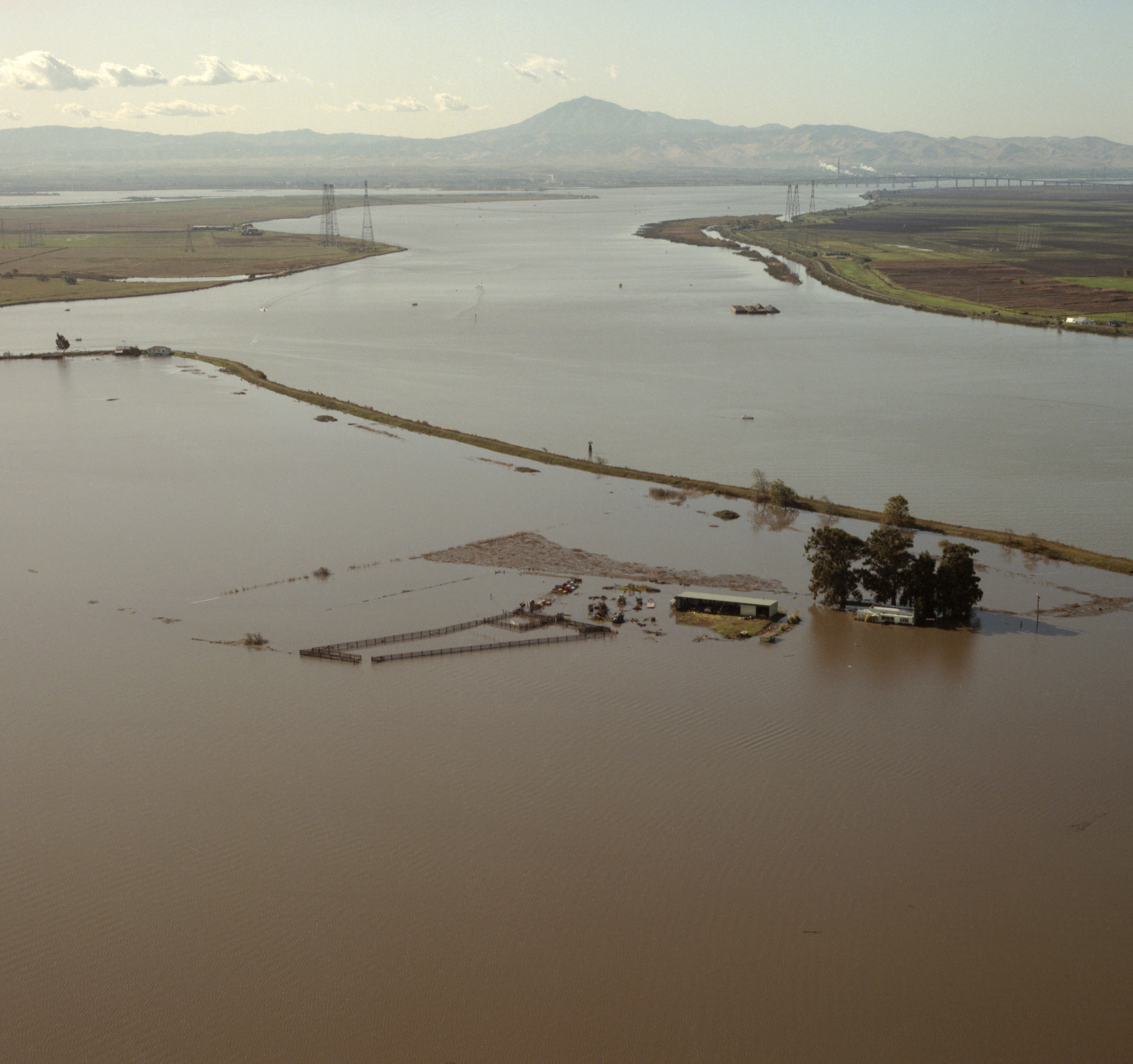
California Department of Water Resources
Floodwaters devastated many homes along Eastern Avenue in Guerneville, California during the January flood of 1995 as seen in this photo taken on Jan. 19. The water level from the Russian River topped a gage height of 48 feet at the Guerneville Bridge and with a peak water discharge of 93,900 cubic feet per second.
36/48
California Department of Water Resources
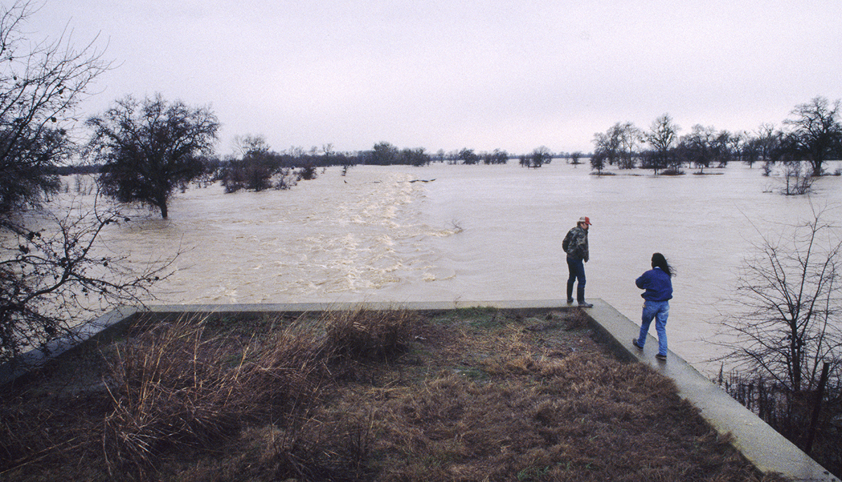
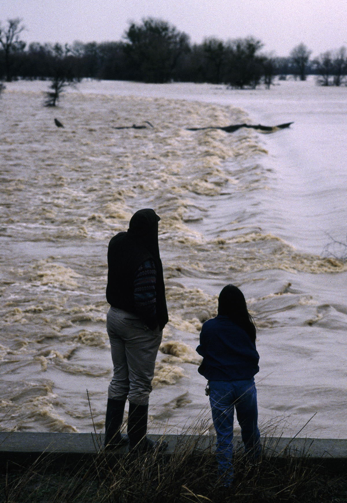
Resident check the floodwater conditions near the Fremont Weir near the confluence of the Sacramento and Feathers rivers on Jan. 13, 1995. Severe storms over Northern and Central California resulted in widespread flooding during January of 1995. State and Federal disaster areas were declared in 42 counties with $120 million in damages and claimed 11 lives.
37/48
California Department of Water Resources
Residents look over floodwater conditions near the Fremont Weird in this Jan. 13, 1995 photo. Sonoma County was declared a Federal disaster with $21 million in damage, over 50 roads were closed, 15,000 residents were without power and total displaced persons exceeded 2,000.
38/48
Dale Kolke / California Department of Water Resources
The Northern California flood in early January 1997 forced a breach on the east levee of the Feather River near Country Club Road in Yuba County as seen in this Jan. 3, 1997 photo.
39/48
Dale Kolke/California Department of Water Resources
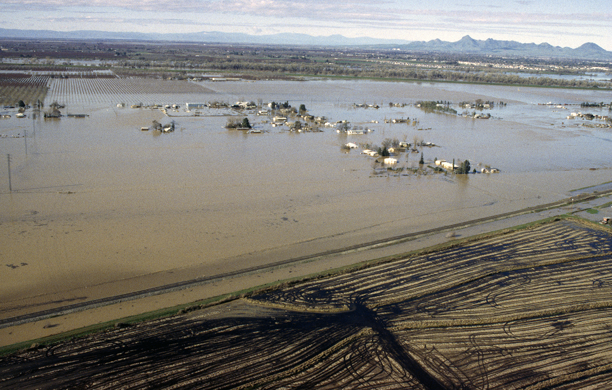
The massive Northern California flood in early January 1997, forced a break on the north levee of the Bear River near old Route 512 on the border of Yuba County and Placer County, California as seen in this photo taken on Jan. 4, 1997. This view looks northeast from the Bear River toward an orchard within Reclamation District No. 784. The Sierra Nevada mountain range received a record rainfall of up to 30 inches, with temperatures above freezing up to 9,000 feet, causing rapid runoff and widespread flooding.
40/48
Dale Kolke/California Department of Water Resources
The massive Northern California flood in early January 1997 forced a breach on the east levee of the Feather River near Country Club Road in Yuba County as seen in this Jan. 4, 1997 photo.
41/48
Dale Kolke/California Department of Water Resources
The massive Northern California flood in early January 1997, forced a break on the east levee of the Feather River at the west end of Country Club Road near the community of Arboga in Yuba County, California. This photo taken Jan. 4, 1997, looks east onto Highway 70 southeast from Country Club Road. At left is the Plumas Arboga Road and railway overpass; at right, the Algodon Road overpass.
42/48
Dale Kolke/California Department of Water Resources
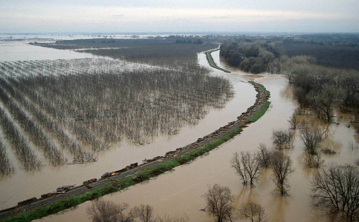
This photo taken Jan. 4, 1997, looks south onto the Feather River east levee relief cut, positioned about one and half miles north of the confluence of the Feather and Bear Rivers. The cut was made to help alleviate the water backup in Reclamation District 784 after the east levee upstream was breached at the end of Country Club Road near the community of Arboga in Yuba County, California.
43/48
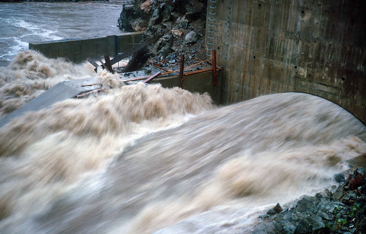
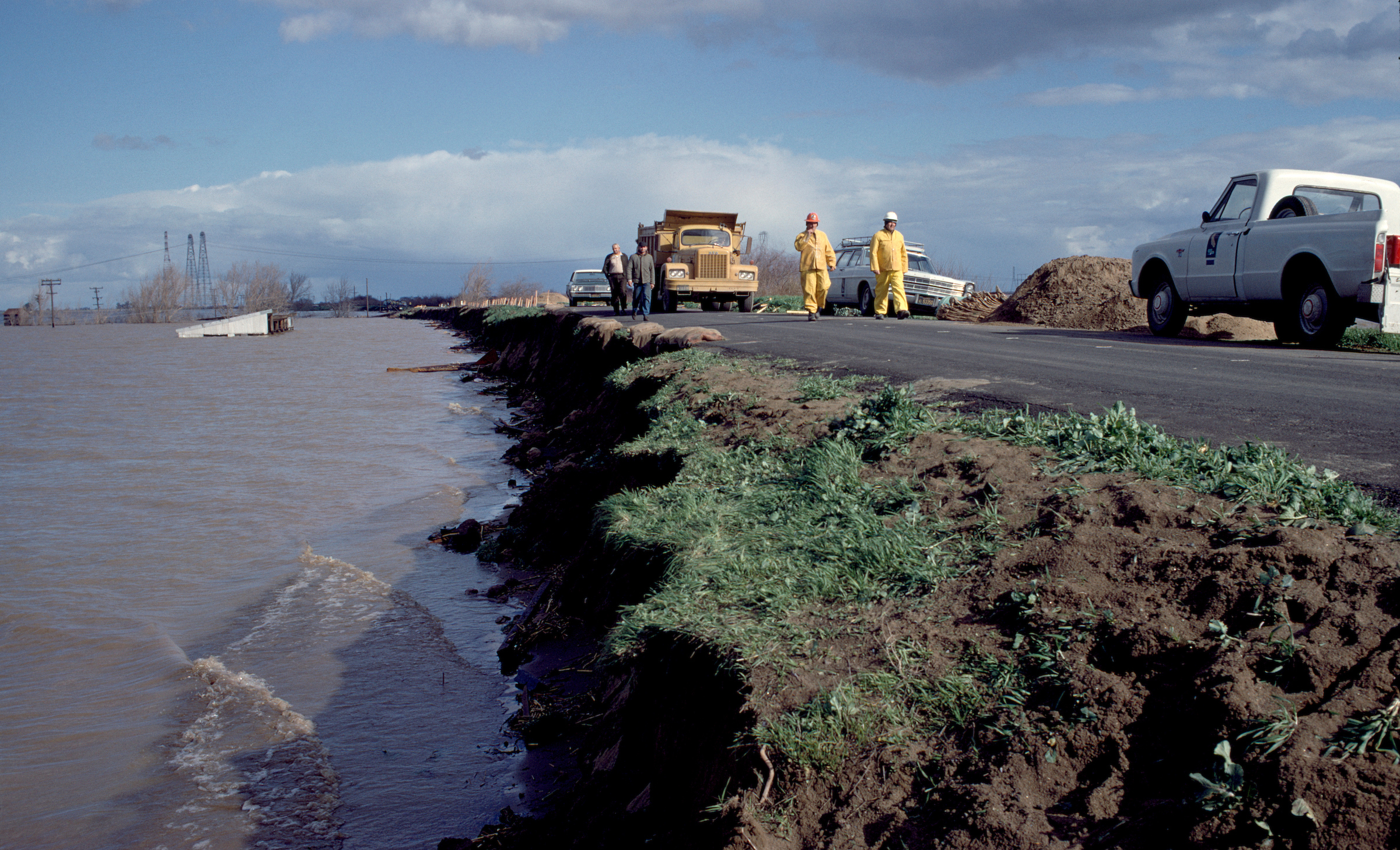
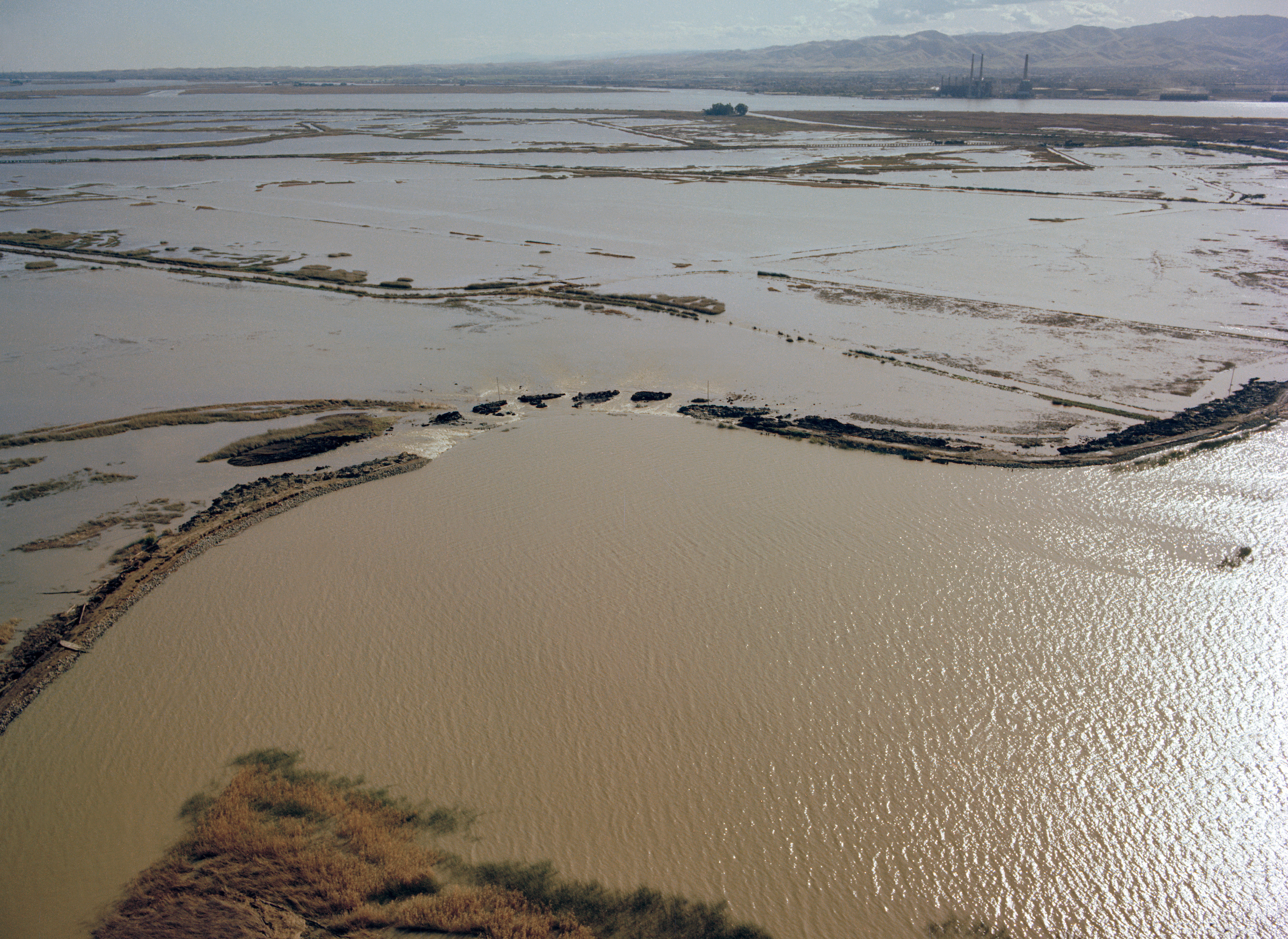
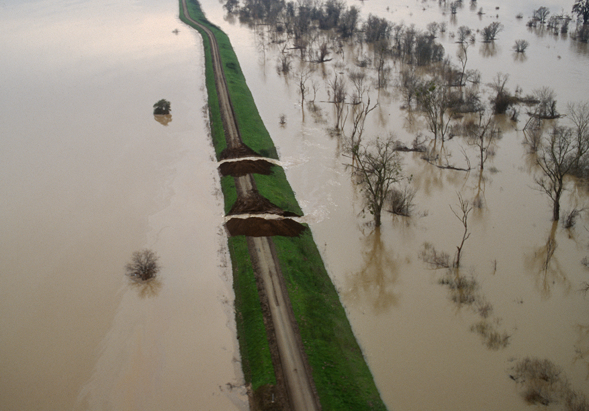
Dale Kolke/California Department of Water Resources
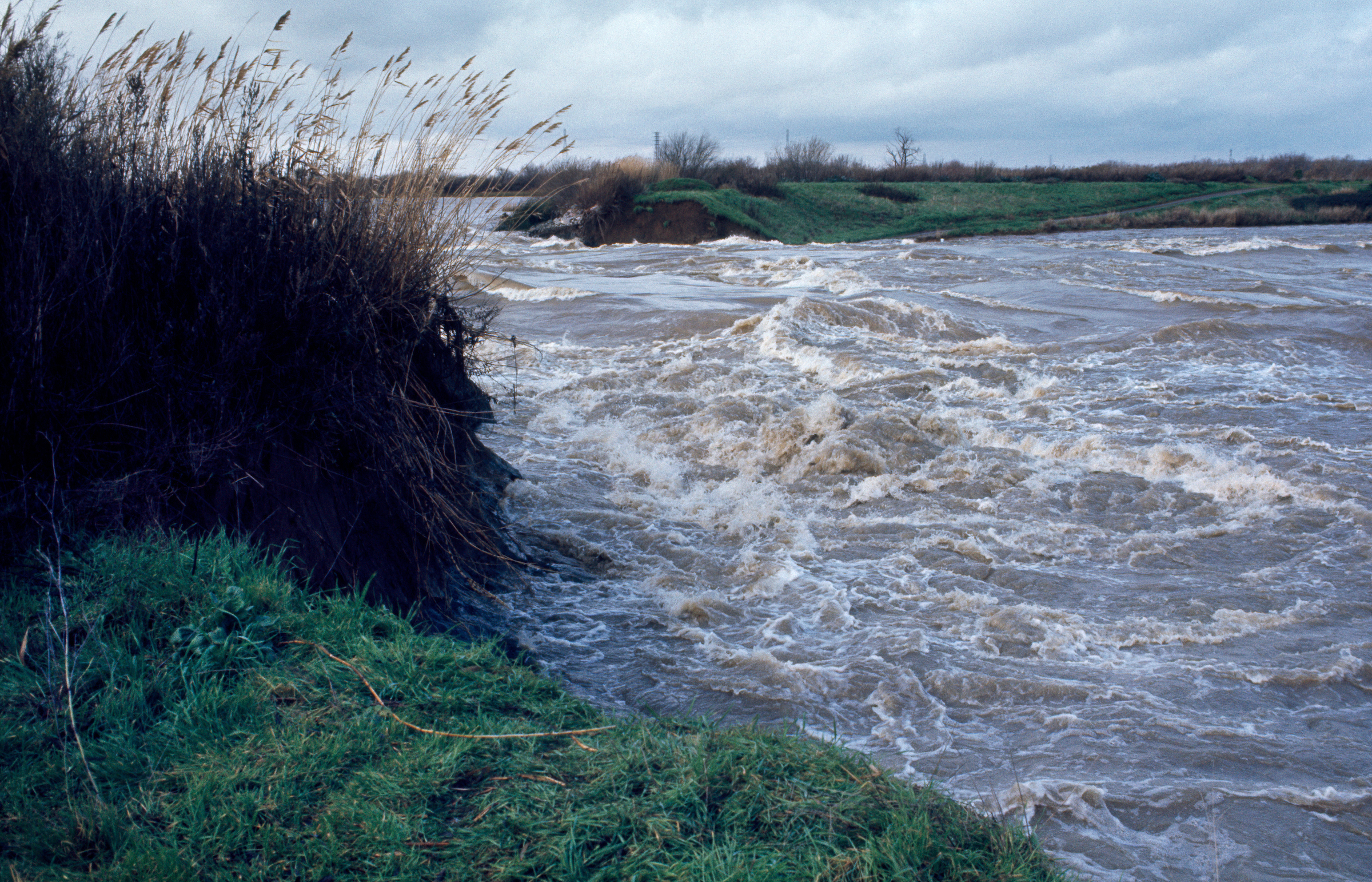
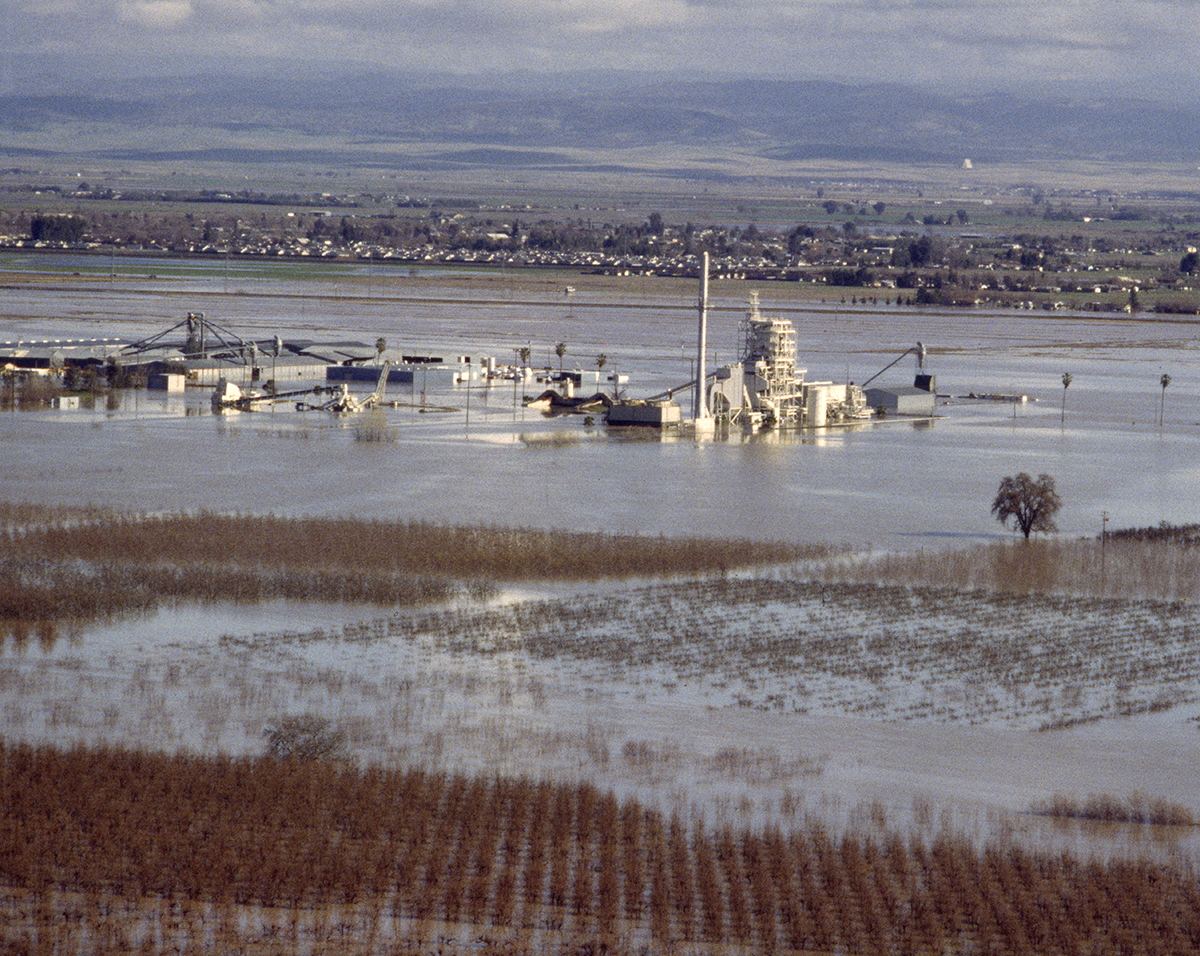
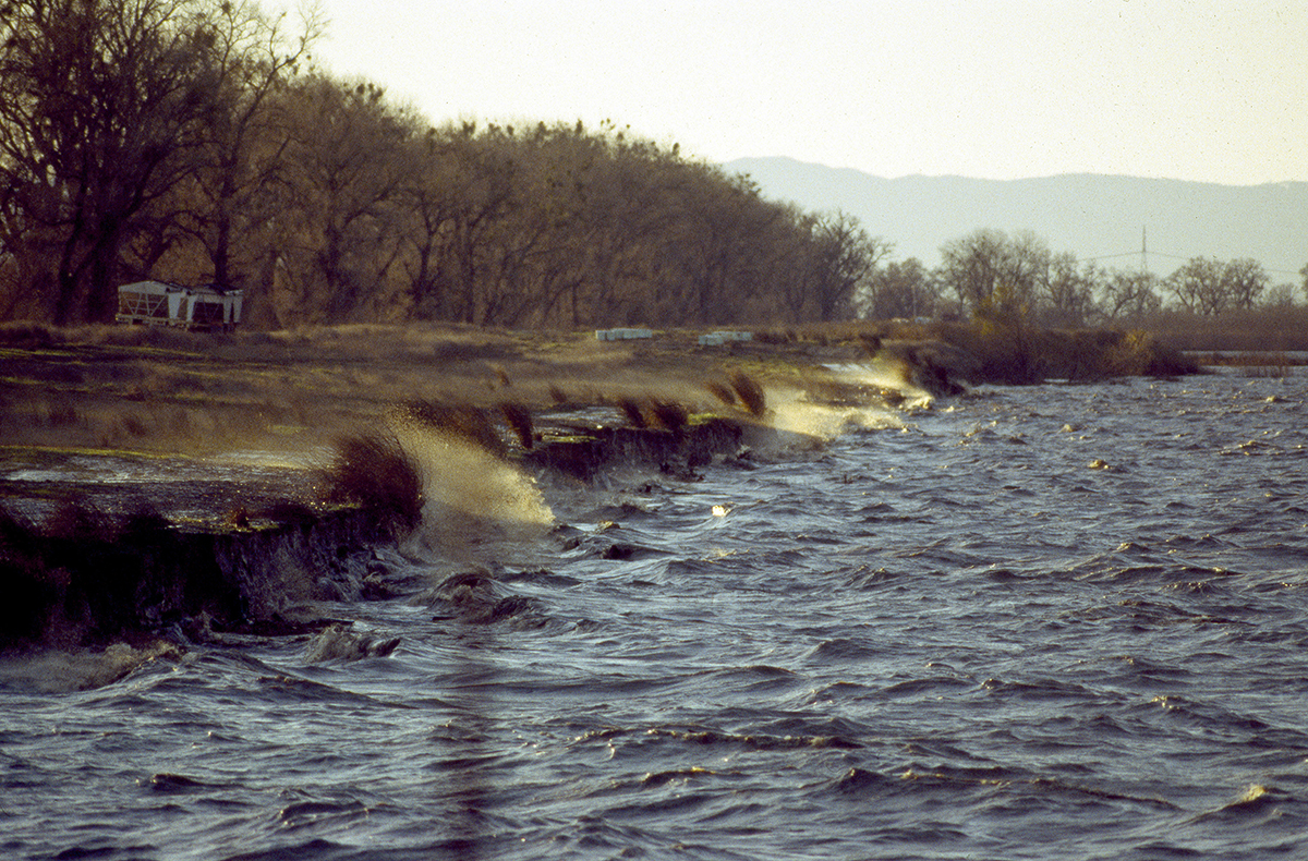
On January 5, 1997, after an “El Nino” type storm occurred in Northern California at the end of December 1996, the western levee of the Sutter Bypass broke in Sutter County near the town of Meridian. The 150-foot break, which forced evacuation of the area, caused flooding over an area estimated to be as large as 100 square miles. This image taken Jan. 5, 1997, shows wave action caused by strong winds in the Sutter Bypass area near the town of Meridian.
44/48
Dale Kolke/California Department of Water Resources
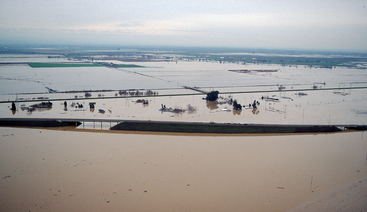
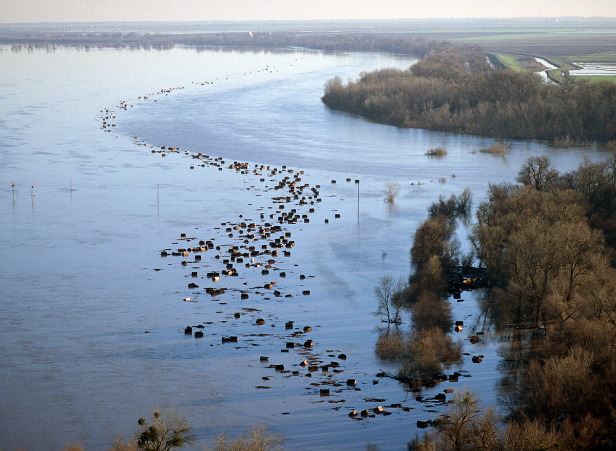
A massive Northern California flood in early January 1997 forced a break in the west levee of the Sutter Bypass near McClatchy Road, inundating much of Reclamation District No. 1660 and District 70 within Sutter County in this photo taken Jan. 7, 1997. Debris from the flood moves down stream south of the flood release excavation near the Tisdale Weir.
45/48
Dale Kolke/California Department of Water Resources
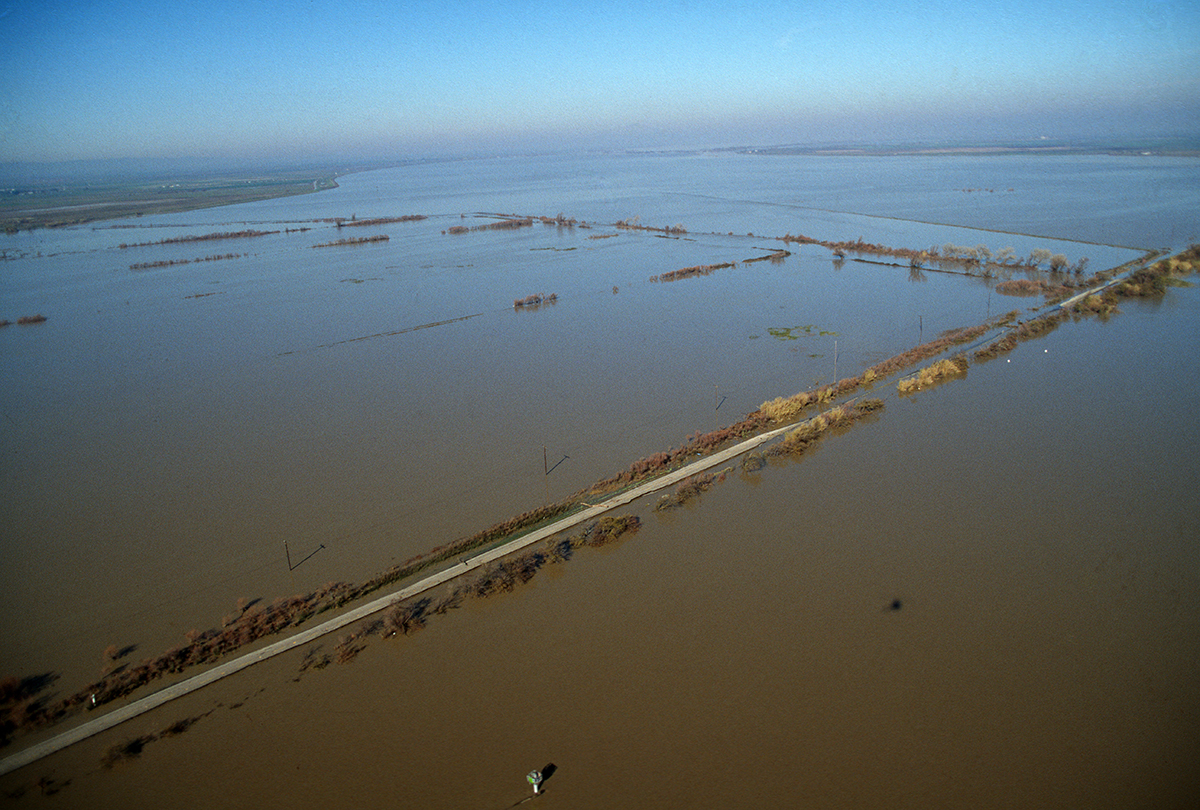
California State Highway 84 just south of the Ryer Island Ferry in eastern Solano County, known as the Cache Slough area, was over taken by flood waters from the southern Yolo Bypass during the massive flood in this photo taken Jan. 7, 1997.
46/48
Eric Risberg/AP
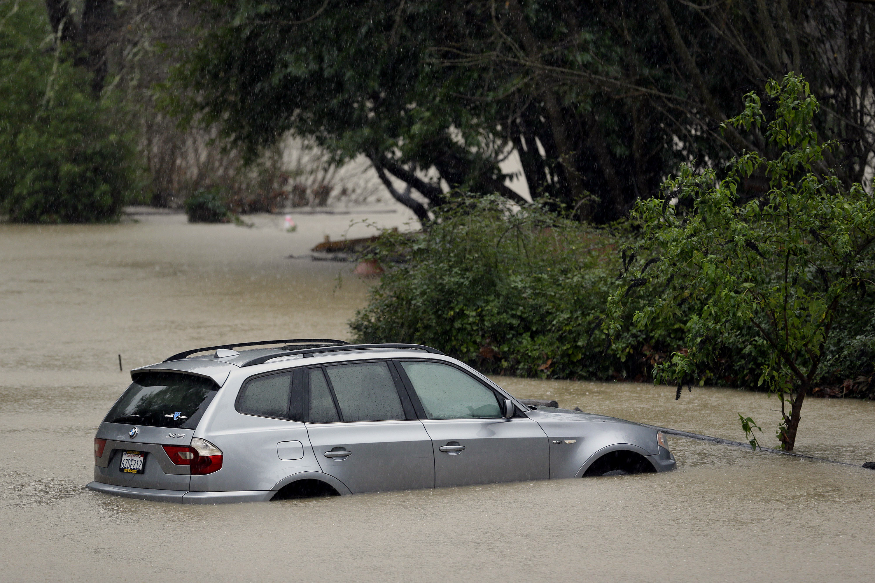
A car is submerged as the Russian River floods Johnson's Beach, Tuesday, Jan. 10, 2017, in Guerneville, California.
47/48
Justin Sullivan/Getty Images
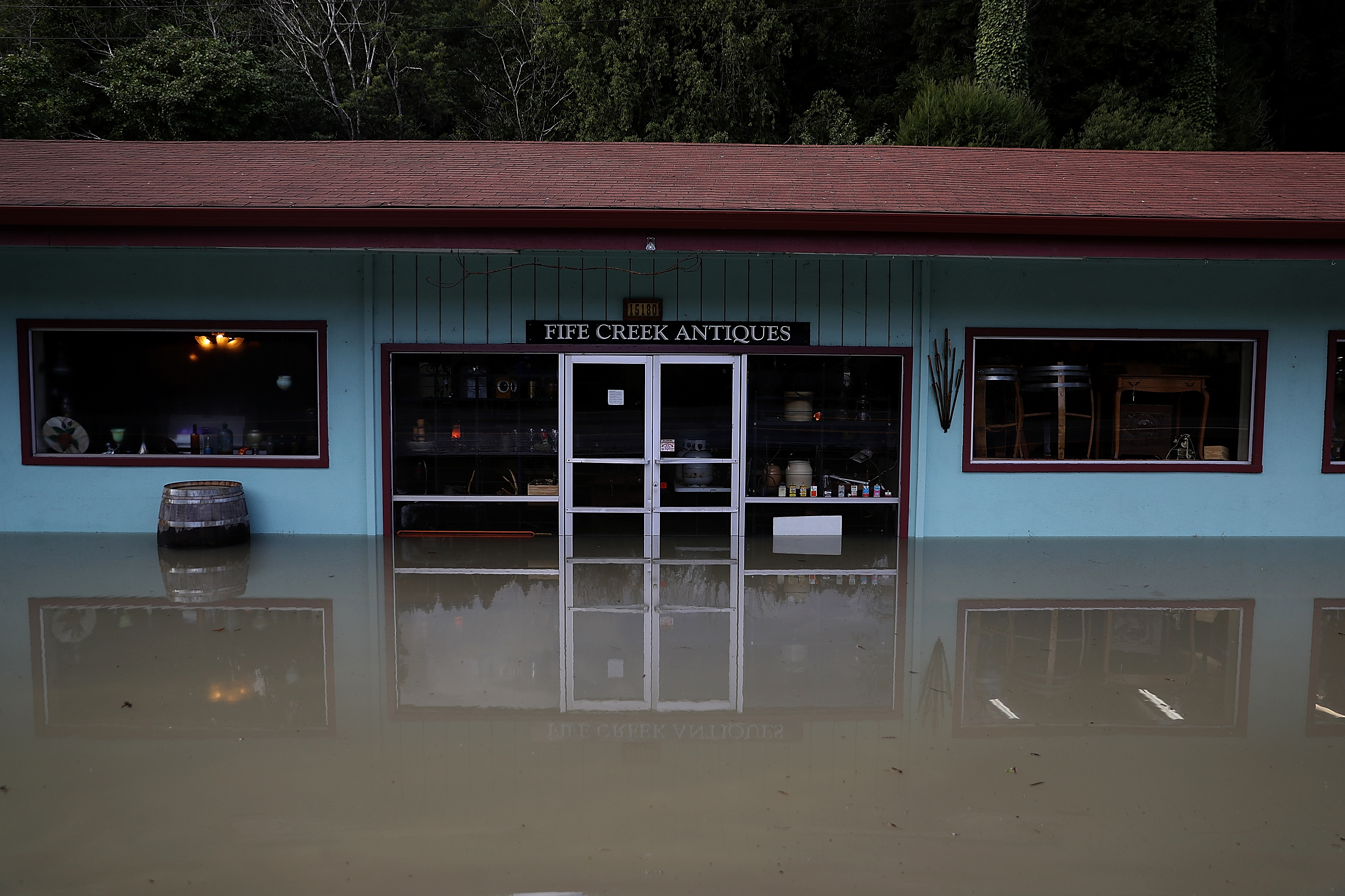
Floodwaters surround an antique store on Jan. 11, 2017 in Guerneville, California. a round of storms brought heavy rains and flooding to Northern California during the first two months of 2017.
48/48
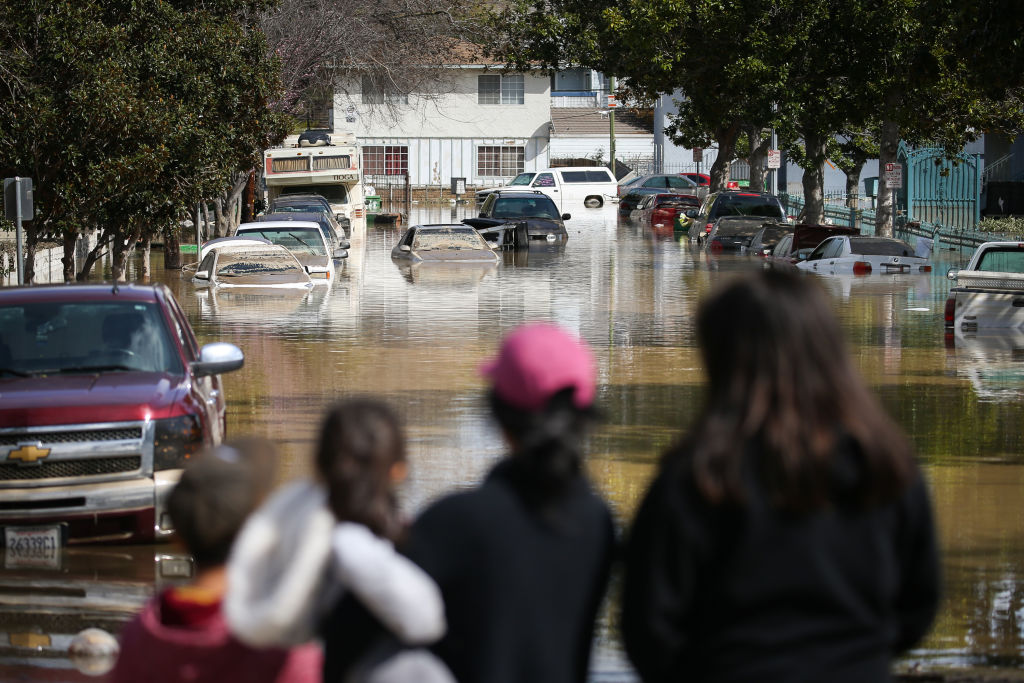
NBC10
SAN JOSE, CA - FEBRUARY 22: People look at cars and homes engulfed in floodwaters on February 22, 2017 in San Jose, California. Flooding on Tuesday prompted the evacuation of over 10,000 people in the area. (Photo by Elijah Nouvelage/Getty Images)