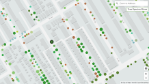
A groundbreaking new digital map heralded as the first-of-its-kind now provides real-time stats on some of the city's tallest residents: its trees.
Nearly 1 million trees around New York City can now be found on a spruced up online map that provides instant access to tree conditions and allows users to report problems directly to the city.
The newly launched NYC Parks map with roots in all five boroughs is currently tracking just above 859,000 trees after combining data from the 650,000 previously mapped street trees and the 150,000 newly mapped park trees.
Billed as "the most comprehensive and up-to-date living tree map in the world," the NYC Tree Map taps into the Parks' forestry database used daily by Parks Foresters. The map expands off the previous version (Street Tree Map) published by the department and, for the first time, lets users see results of completed inspections and recent tree work.
Get Tri-state area news and weather forecasts to your inbox. Sign up for NBC New York newsletters.
On Thursday, for instance, a London planetree on 113th Street in Forest Hills had its soil managed.
But that's not all the map can do. Click on any tree on the map and it'll display details of the tree's species, data on how the tree contributes to a healthier city, as well as the tree's condition.

NYC Tree Map Stats
- Top 3 Landscaped Park Tree Species: London planetree (18,161 trees / 11.6% of total trees), Pin Oak (15,002 trees / 9.6% of total trees), Honey Locust variety (6,929 trees / 4.4% of total trees)
- NYC Parks with the Most Landscaped Park Trees: Flushing Meadows Corona Park (8,698 trees), Prospect Park (3,995 trees)
- Borough by Borough Landscaped Park Trees: Queens (40,617), Manhattan (39,273) Bronx (33,338), Brooklyn (32,580), Staten Island (10,817)
- Number of Landscaped Tree Varieties: 570 different types of trees on streets and in parks

