


Storm Team 4 is WeatheRate-certified as the tri-state's most accurate forecasting team, featuring Janice huff, Dave Price, Maria LaRosa and Raphael Miranda.
The Latest
-
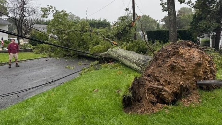
Powerful nor'easter slams tri-state, flooding coastal areas
NYCHA said one of its employees was killed by a fallen tree in Brooklyn, as the storm pelted the city with rain and strong winds.
-
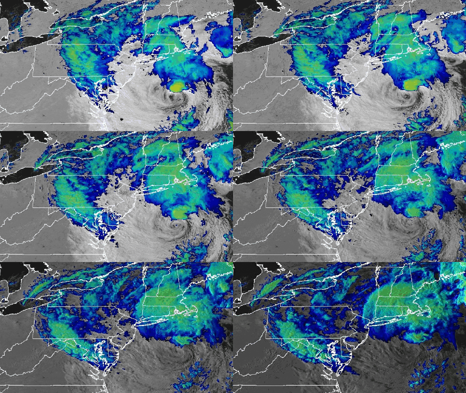
Nor'easter brings 60+ mph winds, coastal flooding for NYC, Long Island and New Jersey
High wind warnings and advisories are in effect across the tri-state, with some of the heaviest gusts coming along the coasts, which have seen winds of 65+ mph. Coastal flood warnings are in effect as well. New York and New Jersey declared states of emergency for areas impacted.
-
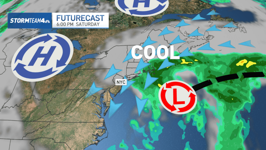
Powerful nor'easter to wreak havoc on coastal Long Island, New Jersey: What to know
Saturday will be the apex of the storm, with the combination of wind and rough surf.
-
Nor'easter threatens 50 mph winds, coastal flooding for parts of Long Island, NJ
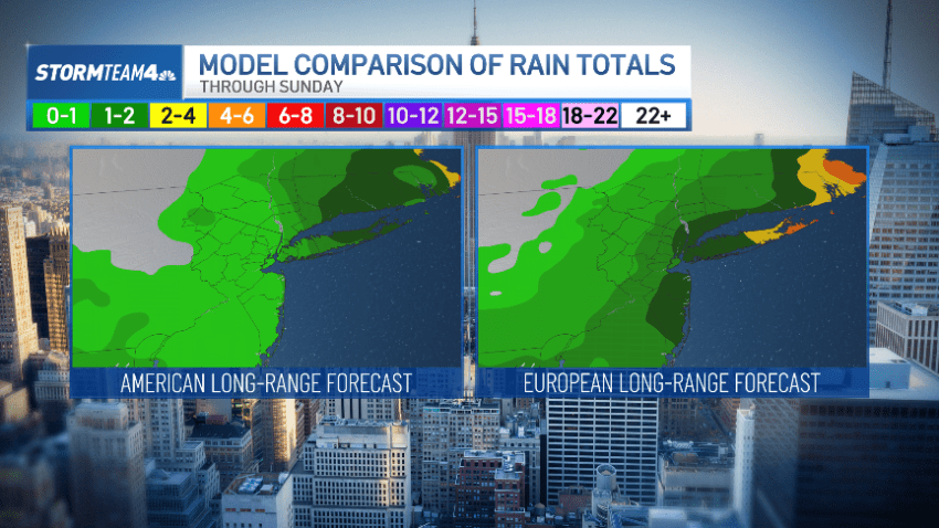
The track of the low is becoming more certain as the European and American long-range forecast models begin to converge on a similar solution.
-
What we know (and don't) about this weekend's nor'easter so far
Much is uncertain. Any strong impacts, though, would likely be confined to the coasts of Long Island and New Jersey. The rest of us may see wind and rain.
-
Nor'easter could bring wet, windy weekend weather — but how much depends on storm track
Currently, the European forecast model predicts a stronger low that is closer to the coast. The American forecast model, on the other hand, indicates a weaker low farther east.
-
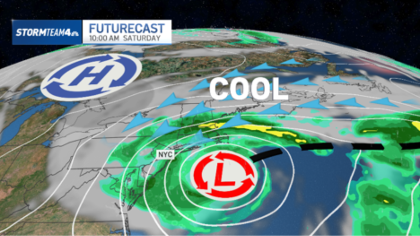
A nor'easter already?!? Weekend storm could slam coast — but no snow in forecast
If the storm deepens and passes just offshore — as with the European forecast — rain totals could exceed 3-4 inches in parts of Long Island.
-
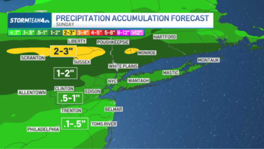
For second Sunday in a row, rainy end to weekend will bring flood threat to tri-state
A low-pressure system will tap into deep atmospheric moisture to end the weekend, ushering in the second Sunday in a row with flood potential.
-
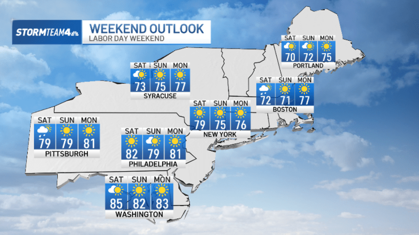
Got plans? Here's your very latest Labor Day weekend forecast (beaches are in)
The timing is perfect, as the latest spate of stormy weather wraps up just as the weekend begins. We start to pivot on Friday.
-
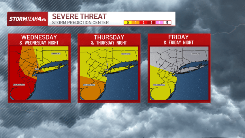
Severe storms, heat impact parts of tri-state through Thursday: What to know
The greatest risk for severe weather overnight will be in Western New York and Pennsylvania, where wind, flooding, hail and even tornadoes are all quite likely.
