


Latest Forecast From Storm Team 4
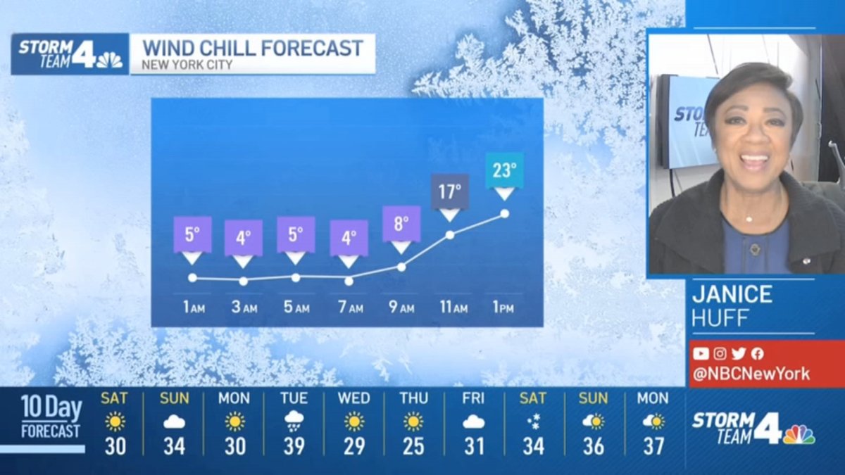
Frigid air stays in the tri-state area through the weekend, sending wind chills below zero for much of the region. Highs aren't expected to top freezing until Sunday.
Overnight lows will be in the teens and single digits, and Saturday will only warm up to the upper 20s.
It won't get much better after that, as it will barely get above the freezing mark on Sunday. Saturday will feature plenty of sunshine, but it won't do much to help warm up anyone spending time outside, which should be limited in the potentially dangerous cold.
Get Tri-state area news and weather forecasts to your inbox. Sign up for NBC New York newsletters.
Temperatures will get back to around — or even above — normal on Tuesday, but then temperatures plummet right back down into the 20s Wednesday and the single digits and teens overnight into Thursday.
Fortunately, no precipitation is expected for most of next week, save for some possible showers on Tuesday, when temperatures could approach 40 degrees, meaning no snow.
Local


The next chance to catch any of the white stuff may not be until the following weekend. Much could change, of course, so stay with Storm Team 4 for the latest and track any approaching precipitation using our interactive radar below.

