Harrowing Escapes, Heartbreaking Loss in Northern California
One woman described the fire that destroyed her house as a 'big tsunami'
•
In the days since a ferocious, wind-whipped wildfire began tearing through this Northern California town, residents who stayed behind to try to save their property or who managed to get back to their neighborhoods despite mandatory evacuation orders found cars incinerated and homes reduced to rubble. They have tales of harrowing escape and struggling to cope with loss.
Getty Images
San Francisco firefighters dismantle a burned mobile home as they search for human remains at a mobile home park that was destroyed by the Camp Fire on November 14, 2018 in Paradise, California. (Photo by Justin Sullivan/Getty Images)
Getty Images
Noah Fisher looks over his home that was destroyed by the Camp Fire on November 22, 2018 in Paradise, California. (Photo by Justin Sullivan/Getty Images)
Getty Images
Brandy Powell looks through the remains of her home that was destroyed by the Camp Fire on November 22, 2018 in Paradise, California. (Photo by Justin Sullivan/Getty Images)
Getty Images
A view of home destroyed by the Camp Fire on November 22, 2018 in Paradise, California. (Photo by Justin Sullivan/Getty Images)
Getty Images
Camp Fire evacuee wait in line to receive a free Thanksgiving meal at Sierra Nevada Brewery on November 22, 2018 in Chico, California. (Photo by Justin Sullivan/Getty Images)
Getty Images
A search and rescue crew member searches for human remains at a mobile home park that was destroyed by the Camp Fire on November 21, 2018 in Paradise, California. (Photo by Justin Sullivan/Getty Images)
Getty Images
An air mask hangs on an altar during a vigil for Camp Fire victims at the First Christian Church of Chico on November 18, 2018 in Chico, California. (Photo by Noah Berger-Pool/Getty Images)
Getty Images
Mourners pray during a vigil for Camp Fire victims at the First Christian Church of Chico on November 18, 2018 in Chico, California. (Photo by Noah Berger-Pool/Getty Images)
Getty Images
Lidia Steineman, who lost her home in the Camp Fire, prays during a vigil for fire victims at the First Christian Church of Chico on November 18, 2018 in Chico, California. (Photo by Noah Berger-Pool/Getty Images)
Getty Images
Gov.-elect Gavin Newson, FEMA Director Brock Long, President Donald Trump, Paradise mayor Jody Jones and Gov. Jerry Brown tour the Skyway Villa Mobile Home and RV Park during Trump's visit of the Camp Fire in Paradise, California on November 17, 2018. (Photo by Paul Kitagaki Jr.-Pool/Getty Images)
Getty Images
President Donald Trump, FEMA Director Brock Long, Gov. Jerry Brown, Gov.-elect Gavin Newson and Paradise mayor Jody Jones tour the Skyway Villa Mobile Home and RV Park during Trump's visit of the Camp Fire in Paradise, California on November 17, 2018. (Photo by Paul Kitagaki Jr.-Pool/Getty Images)
Getty Images
Rescue workers search an area where they discovered suspected human remians in a home destroyed by the Camp Fire on November 16, 2018 in Paradise, California. (Photo by Justin Sullivan/Getty Images)
Getty Images
A rescue worker and her cadaver dog search the Paradise Gardens apartments for victims of the Camp Fire on November 16, 2018 in Paradise, California. (Photo by Justin Sullivan/Getty Images)
Getty Images
A car with the words 'Paradise Strong' painted on the window drives through a Walmart parking lot where Camp Fire evacuees have been staying on November 16, 2018 in Chico, California. (Photo by Justin Sullivan/Getty Images)
Getty Images
Camp Fire evacuee Kelly Boyer plays guitar in front of his tent next to a Walmart parking on November 16, 2018 in Chico, California. (Photo by Justin Sullivan/Getty Images)
Getty Images
A rescue worker uses a cadaver dog to search for human remains at a mobile home park that was destroyed by the Camp Fire on November 14, 2018 in Paradise, California. (Photo by Justin Sullivan/Getty Images)
Getty Images
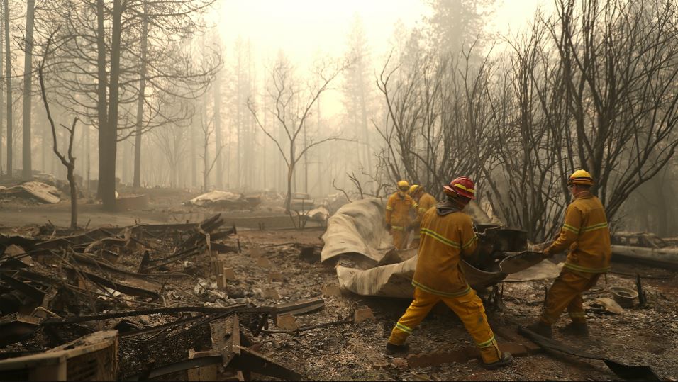
San Francisco firefighters dismantle a burned mobile home as they search for human remains at a mobile home park that was destroyed by the Camp Fire on November 14, 2018 in Paradise, California. (Photo by Justin Sullivan/Getty Images)
Getty Images
A rescue worker uses a cadaver dog to search for human remains at a mobile home park that was destroyed by the Camp Fire on November 14, 2018 in Paradise, California. (Photo by Justin Sullivan/Getty Images)
Getty Images
Rescue workers search for human remains at a mobile home park that was destroyed by the Camp Fire on November 14, 2018 in Paradise, California. (Photo by Justin Sullivan/Getty Images)
Getty Images
Rescue workers search for human remains at a mobile home park that was destroyed by the Camp Fire on November 14, 2018 in Paradise, California. (Photo by Justin Sullivan/Getty Images)
Getty Images
(L-R) California Governor Jerry Brown, FEMA Administrator Brock Long and U.S. Secretary of the Interior Ryan Zinke tour a school burned by the Camp Fire on November 14, 2018 in Paradise, California. (Photo by Justin Sullivan/Getty Images)
Getty Images
The Camp Fire burns in the hills on November 11, 2018 near Oroville, California. (Photo by Justin Sullivan/Getty Images)
Getty Images
A helicopter drops water on the Camp Fire as it burns in the hills on November 11, 2018 near Cresta, California. (Photo by Justin Sullivan/Getty Images)
Getty Images
A burned out car sits next gas pumps at a gas station that was destroyed by the Camp Fire on November 11, 2018 near Parkhill, California. (Photo by Justin Sullivan/Getty Images)
Getty Images
A burned gas pump remains at a gas station that was destroyed by the Camp Fire on November 11, 2018 near Parkhill, California. (Photo by Justin Sullivan/Getty Images)
CSNPhilly.com
Yuba and Butte County sherriff deputies search a destroyed home for a reported victim of the Camp Fire on November 10, 2018 in Paradise, California. (Photo by Justin Sullivan/Getty Images)
Getty Images
A Butte County sherriff deputy searches the property of a destroyed home for a reported Camp Fire victim on November 10, 2018 in Paradise, California. (Photo by Justin Sullivan/Getty Images)
Getty Images
A view of a mobile home park that was destroyed by the Camp Fire on November 10, 2018 in Paradise, California. (Photo by Justin Sullivan/Getty Images)
Getty Images
Eric England holds a jewelry tray in the shape of California that he pulled out of his friend's car that was burned by the Camp Fire on November 10, 2018 in Paradise, California. (Photo by Justin Sullivan/Getty Images)
Getty Images
Power lines rest on cars that were burned by the Camp Fire on November 10, 2018 in Paradise, California. (Photo by Justin Sullivan/Getty Images)
Getty Images
Power lines rest on cars that were burned by the Camp Fire on November 10, 2018 in Paradise, California. (Photo by Justin Sullivan/Getty Images)
Getty Images
The Camp Fire burns in the hills on November 10, 2018 near Big Bend, California. (Photo by Justin Sullivan/Getty Images)
Getty Images
A line of burned out abandoned cars sit on the road after the Camp Fire moved through the area on November 9, 2018 in Paradise, California. (Photo by Justin Sullivan/Getty Images)
Getty Images
Firefighters try to keep flames from burning home from spreading to a neighboring apartment complex as they battle the Camp Fire on November 9, 2018 in Paradise, California. (Photo by Justin Sullivan/Getty Images)
Getty Images
A business that was destroyed by the Camp Fire continues to smolder on November 9, 2018 in Paradise, California. (Photo by Justin Sullivan/Getty Images)
Getty Images
Cal Fire Captain Steve Millosovich carries a cage full of cats that were found in the road after the Camp Fire moved through the area on November 9, 2018 in Big Bend, California. (Photo by Justin Sullivan/Getty Images)
Getty Images
A Cal Fire firefighter monitors a burning home as the Camp Fire moves through the area on November 9, 2018 in Magalia, California. (Photo by Justin Sullivan/Getty Images)
Noah Berger/AP
Flames consume a building as the Camp Fire tears through Paradise, California, Nov. 8, 2018. A California fire official says a fast-moving wildfire in Northern California has destroyed structures and injured civilians.
Justin Sullivan/Getty Images
Hospital workers from the Feather River Hospital work in a triage area while evacuating patients as the Camp Fire moves through the area on Nov. 8, 2018 in Paradise, California.
Justin Sullivan/Getty Images
Hospital workers and first responders evacuate patients from the Feather River Hospital as the Camp Fire moves through the area on Nov. 8, 2018, in Paradise, California.
Justin Sullivan/Getty Images
A hospital worker embraces her co-worker as they evacuate patients from the Feather River Hospital during the Camp Fire on Nov. 8, 2018, in Paradise, California. Fueled by high winds and low humidity, the rapidly spreading Camp Fire has ripped through the town of Paradise and has quickly charred 18,000 acres in a matter of hours.
Justin Sullivan/Getty Images
Embers blow in the wind as the Camp Fire burns down a KFC restaurant on Nov. 8, 2018, in Paradise, California. Fueled by high winds and low humidity, the rapidly spreading wildfire has ripped through the town of Paradise, charring 18,000 acres and destroying dozens of homes in a matter of hours.
Noah Berger/AP
A home burns as the Camp Fire rages through Paradise, California, Nov. 8, 2018. Tens of thousands of people fled a fast-moving wildfire Thursday in Northern California, some clutching babies and pets as they abandoned vehicles and struck out on foot ahead of the flames that forced the evacuation of an entire town.
Noah Berger/AP
Flames consume The Screen & Window Shop as the Camp Fire tears through Paradise, California, Nov. 8, 2018.
Noah Berger/AP
A home burns as the Camp Fire rages through Paradise, California, Nov. 8, 2018.
Don Thompson/AP
Smoke from the Camp Fire, burning in the Feather River Canyon near Paradise, Calif., darkens the sky above the Butte College sig in Oroville, Calif., Thursday, Nov. 8, 2018.
David Banks
Smoke from the Camp Fire, burning in the Feather River Canyon near Paradise, Calif., darkens the sky on Thursday, Nov. 8, 2018.
David Banks
Smoke from the Camp Fire, burning in the Feather River Canyon near Paradise, Calif., darkens the sky on Thursday, Nov. 8, 2018.
Cal Fire
Smoke from the Camp Fire, burning in the Feather River Canyon near Paradise, Calif., rises above tall trees on Thursday, Nov. 8, 2018.
Cal Fire
Cal Fire officials responding to the Camp Fire burning in the Feather River Canyon near Paradise, Calif., on Thursday, Nov. 8, 2018.
Cal Fire
Cal Fire officials respond to the Camp Fire burning in the Feather River Canyon near Paradise, Calif., on Thursday, Nov. 8, 2018.
Cal Fire
Cal Fire officials respond to the Camp Fire burning in the Feather River Canyon near Paradise, Calif., on Thursday, Nov. 8, 2018.
Oroville businesswoman Tracy Grant has taken in a 93-year-old World War II veteran who doesn't know if his home in Paradise is still standing after a deadly wildfire swept through.
Grant said Sunday she was handing out hamburgers to evacuees Thursday at the Forebay Aquatic Center, which is about 20 miles (32 kilometers) south of Paradise, when she encountered Lee Brundige in his car.
He initially refused the hamburger she offered, saying she should give it to someone who really needed it. She tried to get him to a shelter, but he said he was fine sleeping in his car.
The next day, she convinced him to come home with her when the sheriff's office told people to clear out of the parking lot due to worsening air.
"He looks at me and kind of grunted, 'No I don't want to take advantage of anyone, you're too kind.' So I said, 'This is my car. You're going to follow that bumper until we stop," she said.
Her small dog Axle has kept Brundige company in the recliner they share. Grant says Brundige's son knows he's safe but she posted his father's photo on social media so his friends know too.
There may be one more Clinton on the campaign trail this fall.
One of the victims of the fire was an ailing woman whose body was found in bed in a burnt house in Concow.
Ellen Walker, who was in her early 70s, was home alone and probably on medications when the massive wildfire struck the town of Paradise and surrounding communities on Thursday, according to Nancy Breeding.
Breeding said Walker's husband Lon was at work and called a neighbor to tell his wife to evacuate, but it's unclear whether she was alert at the time. He assumed she had escaped the inferno and was trying to find her at rescue centers when authorities confirmed her death late Friday.
"He didn't know that she hadn't got out," Breeding said.
"They were married for 20-something years. He's having a difficult time accepting," she said. "This is a devastating thing, and it's happening to so many people."
NASA
NASA’s Aqua satellite captured this image of Earth Sept. 15 show fires in the U.S. West, smoke from those fires drifting eat, and several hurricanes, including Sally on the Gulf Coast. The red dots represent areas with a heat spike, indicative of wildfires. Karina which is moving away from the Baja California area.
NASA
This image taken by Suomi NPP on August 30, 2020 of the smoke and fires in California.
NASA
NASA’s Terra satellite captured the huge swath of smoke that has been generated by the California wildfires and dispersed by the winds surrounding those fires on August 20, 2020. This plume was estimated at about 1,200 miles long.
NASA/GOES
A satellite image captured Thursday Aug. 20, 2020 shows smoke from those fires shrouding most of California and much of the U.S. West
NASA
Smoke from Australia’s bushfires can be seen in this NASA image from Jan. 4, 2020.
NASA
The brushfire outlook is grim at the start of the new year. This photo shows fire, represented by red dots, and smoke plumes Jan. 1, 2020.
NASA
Wildfires north of the Bay Area are seen Nov. 1, 2019 from the Space Station.
NASA
Wildfires north of the Bay Area can be seen from 254 above the Golden State in this photo captured by a crew member aboard the International Space Station.
NASA
Wildfires north of the Bay Area can be seen in this photo from NASA astronaut Andrew Morgan aboard the International Space Station.
NASA
The NASA Terra satellite captured the Getty Fire with its smoke plume drifting off the coast of California on Oct. 30, 2019
NASA Worldview, Earth Observing System Data and Information System (EOSDIS)
A NASA satellite captured this smoke plume from the Getty Fire shortly after the fire started early Oct. 28, 2019 in the hills overlooking the 405 Freeway through Los Angeles' Sepulveda Pass. The fire forced evacuations and destroyed eight structures.
NASA Worldview, Earth Observing System Data and Information System (EOSDIS)
NASA's Terra satellite captured a image of the Kincaid wildfire located in Northern California's Sonoma County which broke out on Wednesday night and has grown to over 20,000 acres in less than 48 hours.
NASA Worldview, Earth Observing System Data and Information System (EOSDIS)
A smoke plume from a fire in Eldorado National Forest stretched from southwest of Lake Tahoe to over 100 miles west, reaching Sacramento. The fire was captured Oct. 10, 2019 in this image from NASA's Aqua satellite.
NASA Worldview, Earth Observing System Data and Information System (EOSDIS)
The Tenaja Fire burns Sept. 4, 2019 in Riverside County. The fire grew quickly from 25 to 900 acres in about a day, then jumped to 2,000 acres.
NASA Worldview, Earth Observing System Data and Information System (EOSDIS)
A view of California's Walker Fire, which burned in Plumas National Forest in September 2019.
NASA/NOAA
NASA Worldview, Earth Observing System Data and Information System (EOSDIS)
NASA Worldview, Earth Observing System Data and Information System (EOSDIS)
The burn scar from the deadliest and most destructive wildfire on record in California is visible in this photo from NASA's Terra satellite on Nov. 26, 2018. The burn area near Paradise, northeast of Sacramento, can be seen in dark red. It is estimated to have burned an area about the size of Chicago.
NASA
This Nov. 18, 2018 image shows the vast amount of land in the Santa Monica Mountains burned by the 152-square-mile Woolsey Fire.
NASA
NASA's Terra satellite captured this image of the Woolsey Fire burn scar Nov. 14, 2018 in Ventura and Los Angeles counties. The red areas near Thousand Oaks and south to Malibu indicate the burn area. The brighter red spot between Oxnard and Thousand Oaks denotes an area of active fire. n
NASA
A view of the Camp Fire Tuesday Nov. 13, 2018 in Northern California. At this point, the 125,000-acre fire was only 30-percent contained after it started Nov. 8.
NASA
A view of the Southern California Woolsey Fire Nov. 12, 2018. The fire started Nov. 8 in Ventura County and quickly burned south, jumping the 101 Freeway and heading into Malibu.
NASA Earth Observatory
A view of the Camp Fire (above) in Northern California and the Hill and Woolsey fires in Southern California as seen on Nov. 9, 2018.
NASA Earth Observatory
A view of the Camp Fire in Butte County, California on the day it began Nov. 8, 2018.
NASA
The Camp Fire and its giant smoke plume can be seen in this NASA image on Nov. 8, 2018. This image shows the town of Paradise, California and the surrounding region.
NASA
Dark brown areas in this Aug. 30, 2018 NASA satellite image showed the scorched landscape left behind by California's largest wildfire on record.
NASA
This image show the largest fire in California history burning Aug. 12, 2018. Smoke from the Mendocino Complex fire can be seen as far east as parts of Montana and then up into Canada.
NASA
An Aug. 4, 2018 image from the International Space Station shows long fingers of smoke from California's wildfires, including the state's largest wildfire on record -- the Mendocino Complex.
NASA
A view of the Mendocino Complex fires as seen Aug. 3, 2018 from the International Space Station.
NASA
It's difficult to see the Earth's surface due to smoke from the Mendocino Complex fires and other large blazes in this image posted Aug. 8, 2018.
NASA Earth Observatory image by Joshua Stevens, using Landsat data from the U.S. Geological Survey, GEOS-5 data from the Global Modeling and Assimilation Office at NASA GSFC, and fire perimeters from CAL FIRE
This Aug. 6, 2018 image from Landsat 8 shows the smoke plume rising from Northern California's Ranch fire, part of the Mendocino Complex. The image provides a look at the trees and vegetation, much of it killed during the state's dry spell, that provide fuel to burn.
The three large patches of red in this image captured Aug. 2, 2018 show the Ferguson, Mendocino Complex and Carr fires. Over the weekend of Aug.4-5, the Mendocino Complex fire exploded to become on the five-largest fire on record in California.
NASA
This NASA satellite image shows smoke from several fires, depicted by the red dots, burning in California. The image from the Aqua satellite was captured on July 30, 2018.
NASA
NASA's Terra satellite captured wildfire smoke covering vast parts of California and the U.S. West Coast on July 29, 2018. It shows smoke drifting east into Utah. The red dots indicate fire activity from the Carr fire in Redding, the Ferguson fire near Yosemite National Park, the Cranston fire in Riverside Couty, the River fire in Mendocino County and other burn areas.
NASA
NASA's Terra satellite captured this image of the West Coast of the United States Thursday July 26, 2018. It shows widespread smoke from fires burning from Oregon to the huge smoke plume and fire around Redding and the Ferguson fire near Yosemite. The Cranston fire in Riverside County can be seen at the very bottom edge of the image.
NASA
NASA satellite imagery shows the Ferguson fire burning near Yosemite National Park July 23, 2018.
NASA
Fires depicted in red in this image started in June and continued into July in Colorado. The West Pass fire near Colorado Springs began June 28, 2018 due to a lightning strike. The Spring Creek Fire south of Colorado Springs began a day earlier.
NASA
A large plume of smoke from the County Fire near San Francisco can be see in this image. The fire was growing at a rate of about 1,000 acres per hour, growing overnight form 44,000 acres to 70,000 acres.
NASA
The Dollar Ridge Fire in Utah began July 1, 2018. It quickly grew to more than 7,000 acres. It exploded to 30,000 acres two days later.
NASA
This satellite image shows where wildfires, outlined in red, are burning in California on Thursday June 14, 2018. On the heels of the most destructive wildfires on record in California, there have already been more than 1,800 fires, as of June 10, 2018, in the state so far in this year.
NASA
The Rhea Fire started on Thursday April 12, 2018 during a stretch of high fire danger days in the Midwest. It is located in Dewey County, Oklahoma.n
Lynn Jenner/NASA
Blown over a widespread area by strong winds, smoke from the Thomas fire can be seen Dec. 16, 2017. Winds were forecast to die down for a couple of days before picking up again this week.
NASA satellite imagery shows smoke from the Thomas fire as it burned for an 11th day Wednesday Dec. 13, 2017 in Ventura and Santa Barbara counties.
NASA/Randy Bresnik
This photo was taken Dec. 8 from the International Space Station flyover of Southern California. NASA astronaut Randy Bresnik photographed the plumes of smoke rising from wildfires.
NASA Earth Observatory
A thick stream of smoke is seen above a ridge of clouds from space in this Dec. 5, 2017, MODIS photo taken by NASA's Terra satellite. The Thomas fire, fed by powerful Santa Ana winds, burned through 55,000 acres in Ventura county.
NASA/Lynn Jenner
An Oct. 24, 2017 image from the Advanced Spaceborne Thermal Emission and Reflection Radiometer (ASTER) instrument on NASA's Terra satellite shows the expansive fire scar on the landscape of California's wine country due to the October Fire Siege. Burned areas appear in dark gray, vegetation is displayed in red. The image covers and area of 38 by 39 miles.
NASA
This image captured Wednesday Oct. 11, 2017 shows the deadly and destructive Northern California wildfires after they jumped in size. High cirrus clouds partially obstruct the view of smoke.
NASA
This image of smoke from Northern California's fires was captured Oct. 10, 2017. Together, the wildfires are among the deadliest and most destructive in the state's history.
NASA
This image from NASA's Aqua satellite shows more than a dozen fires burning in Northern California Oct. 9, 2017. The fires were fanned by 60-mph winds in California's wine country.
NASA
This image shows one of Los Angeles' largest wildfires -- the September 2017 La Tuna fire in the foothills north of Los Angeles. In this image from the Advanced Spaceborne Thermal Emission and Reflection Radiometer (ASTER) instrument on NASA's Terra satellite, vegetation is depicted in red -- such as the golf courses visible in the hills above Burbank. Burned area is in dark gray. The image was acquired Oct. 7, 2017.
NASA Goddard MODIS Rapid Response Team and the National Forest Service
Fires appear to light up along the Pacific Crest National Scenic Trail, which aligns with the highest parts of the Sierra Nevada and Cascade mountain ranges. The trail runs through California, Oregon and Washington.
Jeff Schmaltz, MODIS Rapid Response Team
NASA's Suomi NPP satellite imaging system spotted hundreds of fires in southern Africa. You can see them outlined in red. It's likely about half of the fires were deliberately set as part of a slash and burn land management plan. The fires can help improve crops and pastures, but hurt air quality.
Jeff Schmaltz LANCE/EOSDIS MODIS Rapid Response Team, GSFC
This is what happens when smoke from large wildfires gets caught up in the jet stream. NOAA-NASA's Suomi NPP satellite captured this image of smoke from West Coast fires drifting thousands of miles across the United States. If smoke remains in the jet stream, air quality impacts are minimal, but the particles can create unhealthy conditions if they descend. A red or orange sunset is a sign that smoke might be in the atmosphere -- the smoke particles allow longer wavelength colors, such as red or orange, to pass through, but block shorter wavelengths like yellow, blue and green.
Jeff Schmaltz, MODIS Rapid Response Team
This image from the Suomi NPP satellite offers a look at just how much of the Northwest is affected by smoke from wildfires in Washington, Oregon, Northern California, Idaho and other states in the region. The smoke is carrying soot and other fine particles that pose health problems.
This Sept. 1, 2017 image from NASA's Aqua satellite shows seven Pacific Northwest fire complexes -- fires that are make up of several fires that form together. The Chetco Bar fire began in July after a lightning strike along the Rogue River-Siskiyou National Forest. It has grown to more than 131,000 acres. The High Cascades Complex began Aug. 13 due to a lightning strike and burned more than 26,000 acres in Rogue River-Siskiyou and Crater Lake National Park. The Milli Fire began two days earlier and burned more than 22,000 acres, forcing evacuations. Four large fire complexes are labeled in California. Note: Not all wildfires depicted in this image are labeled.
NASA image courtesy Jeff Schmaltz LANCE/EOSDIS MODIS Rapid Response Team, GSFC. Caption by Lynn Jenner
This image shows smoke from wildfire across several Canadian provinces. The smoke is lifted by the jetstream, spreading across British Columbia, Alberta, Saskatchewan, and Manitoba. The natural-color image if from the Aqua satellite's Moderate Resolution Imaging Spectroradiometer -- or just MODIS.
NASA
Dozens of wildfires can be seen in this Terra satellite image taken on Aug, 27, 2017.
NASA
The Moderate Resolution Imaging Spectroradiometer (MODIS) on NASA’s Terra satellite captured this image of wildfires in Oregon. The largest in this image is the Chetco Bar fire, which burned more than 100,000 acres after it was ignited by a lightning strike in mid-July.
Most of Greenland is covered in icy, but the outer regions closer to the sea are not. You can see smoke from a wildfire burning in this image from NASA's Aqua satellite.
NASA
A shift in wind direction pushed smoke from fires in British Columbia toward the coast, as shown in this Aug. 1, 2017 image.
NASA
This image shows the Detweiler Fire burning July 20, 2017 in Northern California near Mariposa.
NASA
This Thermal Infrared Sensor (TIRS) image from the Landsat 8 satellite shows the amount of heat, or thermal energy, radiating from the Detweiler Fire in Northern California. The cooler areas are in dark, warmer areas are bright. The fire can be seen in the lower left of the image.
NASA
This July 10, 2017 image from NASA's Aqua satellite shows plumes of smoke from the Drew, Rooster's Comb and Antelope fires in the western United States. The large red spot in the middle of the image represents Nevada's Rooster's Comb fire. The Drew fire in Nevada is seen in the bottom left. The smoke at the top of the image is from the Antelope fire in Idaho.
NASA
NASA's Terra satellite captured smoke from the Alamo fire July 9, 2017. At the time, the fire in Santa Barbara County was the largest fire burning in California during a summer of high fire danger.
NASA's Aqua satellite captured this image of Nevada's Earthstone and Truckee fires burning July 4, 2017 in Nevada.
NASA
Smoke streams across Canada's Yukon and Northewest Territory on July 9, 2017.
NASA
A smoke plume from a wildfire drifts over the sea south of Turkey. The image over the Toros Mountains was captured July 3, 2017.n
NASA
NASA'S Suomi NPP satellite captured a line of fires burning July 6, 2017 in Kazahkstan. The active burn areas are identified by the red outlines.
NASA
A large forest fire burns June 19, 2017 in Portugal.
NASA
This image shows agricultural fires dotting much of the southern Asian landscape on April 12, 2017.
NASA
The Suomi NPP satellite detected hundreds of fires burning in western and central Africa Feb. 6, 2017.
NASA
This image shows fires, many of which are likely prescribed, burning in the Central Valley region of California in November 2016.
NASA
Part of central Africa appears covered in fire in this June 27, 2017 image from NASA's Suoimi NPP satellite.
NASA
The Brian Head fire started June 17, 2017 in Utah. The Aqua satellite captured this image of the fire when it was at more than 42,800 acres.
NASA
The Pioneer fire in Idaho was at 180,000 acres when this image was taken Sept. 1, 2016.
NASA
The Gap fire in Northern California burned nearly 40,000 acres by the time if was fully contained in September 2016. At the time of this Aug. 31, 2016 image, the fire was only 1,120 acres, but generating a large smoke plume due to heavy fuels and strong winds.
NASA
This image shows wild and prescribed fires burning in the southeastern United States in February 2017. Prescribed fires are set deliberately by wildland fire management agencies to remove underlying brush and dead grass, giving firefighters some help in fire containment.
Cathy Fallon described the fire that destroyed her house as a "big tsunami." She stayed behind and was able to save her 14 horses and barn using a hose, but she lost her house and her husband wound up hospitalized the morning after the fire. He remained hospitalized Saturday after fears he had had a heart attack. Two of her dogs and nine cats died in the fire.
"It was really scary when the rush of a huge amount of fire came up through the canyon at our house and barn," she said. "But it didn't seem to be able to jump to the barn, and I just kept watering the barn and watering any areas in the barn that caught on fire."
She added, "It's a dangerous situation. I remember my son saying, 'Hey! There's no firefighters. We're on our own here.' I'm like, 'Yeah.' We were definitely on our own."
She and her son, Gabriel, were sleeping in the horse stall and had no power or water.
Neighbors Courtenay Jenvey and Glen Walther ignored evacuation orders and fought the blaze with hoses. They were able to save their homes and two other homes, but all other houses for at least a half-mile in all directions were smoldering foundations, they said.
"Surreal, that's the best word I could describe it by," said Walther, who ventured out to see the neighborhood on Saturday for the first time. "I didn't even want to go out, but when I did, by the time I was a quarter-mile down the road down there, I'm bawling like a cut calf."
They also rescued a chocolate Labrador who had been left behind by its owner. The dog has been acting as a guard dog and has lifted their spirits, Jenvey said. The dog chased squirrels, chewed on sticks and sprinted in the black ash in Jenvey's charred orchard of black olive trees as he talked.
Jenvey said he thought he was going to die as he was fighting to save his house and at one point realized he had no choice but to stay — all his exits were blocked by flame. Leaves were catching fire and floating down onto roofs, and the howling fire sounded like a jetliner taking off, he said.
"It was pitch black, black as midnight," he said, his eyes red-rimmed from exhaustion and smoke. "We had active fire, sparks and embers hitting the roof, chunks of bark about a half-inch in diameter, flaming, that were hitting us. It was like rain, and so we were just hitting everything we could that started up as fast as we could with garden hoses."
Shawna Howard, a Paradise resident, said she found out Saturday that her parents' home didn't survive the flames.
"You just sit here in a fog and think you're going to wake up," she said.
She recalled flames lining both sides of the roadway as she evacuated with her 12-year-old daughter.
"The heat, the heat was unreal," she said.
At one point, Howard said she thought they would not make it out alive.
"I was praying out loud the entire time," she said. When she would stop, her daughter would make her start up again, she said.
Associated Press writers Gillian Flaccus, Ryan Tarinelli and Paul Elias contributed to this report.