
What to Know
- Showers are expected to stick around well into Thursday after brief downpours walloped some tri-state spots overnight; parts of Warren County, New Jersey, saw another 4 inches of rain
- New York City could see another inch of rain from this system, though the steadiest rain moved out by Thursday morning; it'll be a pretty gloomy day overall, though
- Hurricane Larry, a strong Category 1 storm, will stay out of the Atlantic but it'll generate significant swells that will affect the East Coast through week's end, causing dangerous surf and rip current conditions
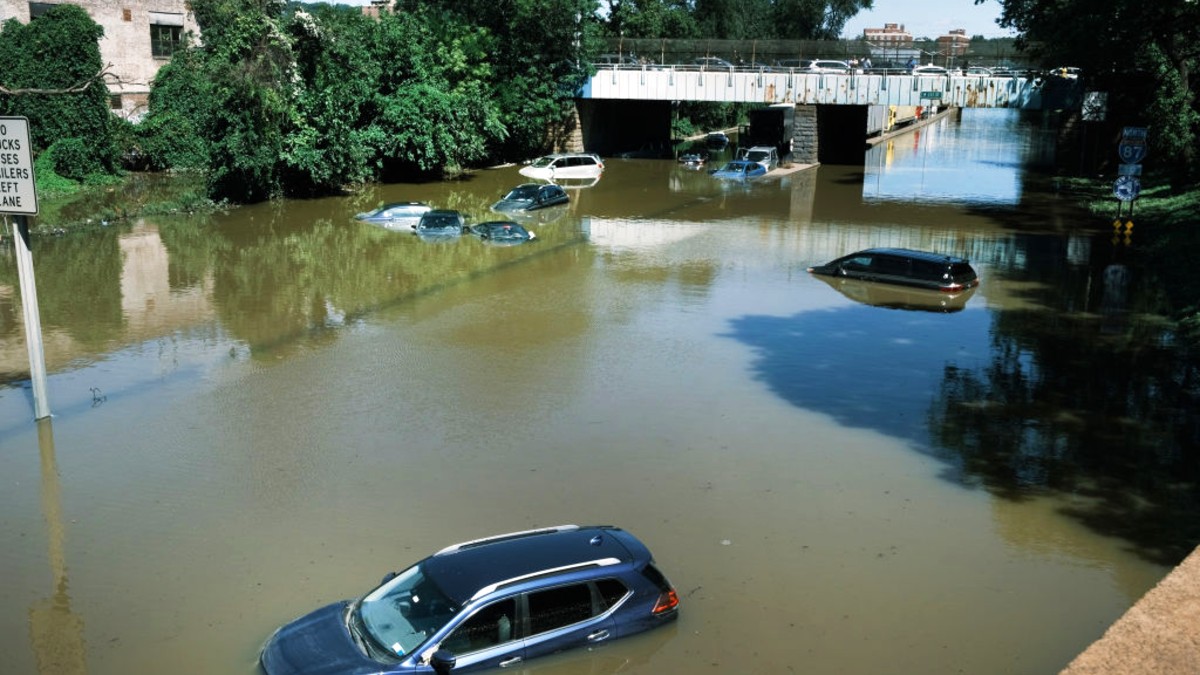
The devastating toll of Ida continues to impact the tri-state area, parts of which saw renewed flash flood threats overnight as yet another system dumped heavy rain in parts of New Jersey and dampened an already saturated New York City.
Strong lines of thunderstorms first moved into New York points north and west of the city late Wednesday and later stretched into northwest New Jersey, triggering flash flood warnings for some into early Thursday.
That warning lingered longest for Warren County, where an estimated 4 inches of rain fell in a six-hour period before the system moved into the New York City area shortly after 1 a.m. Limited rainfall of less than an inch was expected there by the time the heaviest rain moved out around the time of Thursday's peak morning rush.
Get Tri-state area news and weather forecasts to your inbox. Sign up for NBC New York newsletters.
By 5:30 a.m., only a flood warning remained in effect for Warren County while river flood warnings were ongoing for Morris, Passaic and Essex counties. Check the latest severe weather alerts for your neighborhood here.
A stationary front parked just east of New York City will keep Thursday rather gray and gloomy with highs in the low-to-mid 70s. It'll be a damp one for most in the tri-state area, especially for spots south and east of the I-95 corridor, where the steadiest and heaviest rain is expected to fall. Conditions dry out overnight.
No serious new damage was reported from this latest stormy bout, though officials were prepared to sound any alarms necessary to keep people safe from floods after Ida's record-breaking rainfall last week, including New York City Mayor Bill de Blasio.
In the aftermath of the storm that killed 13 in Queens and Brooklyn, de Blasio laid out a new severe weather plan that he says will help the city better prepare to combat what climate experts expect to be increasingly frequent weather disasters.
The mayor tapped into that plan for the first time Wednesday, acknowledging the forecast called for just a half-inch to an inch of rain for the city but well aware of how devastatingly Ida's deluges outdid rain forecasts only a week ago.
More on Ida's Aftermath
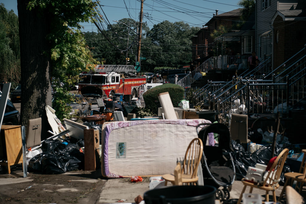
He said city agencies would be out in force to assist in any emergent weather-related issues that may compound the ones from last week.
New Jersey was initially expected to get less rainfall than parts of New York from this system, but any additional water was considered to be a threat.
Gov. Phil Murphy reminded the people of his state to stay safe ahead of the storms.
New York Gov. Kathy Hochul did the same, especially for areas expected to be most impacted by Wednesday storms including Orange, Rockland and Sullivan counties.
"We witnessed the painful devastation left by the remnants of Hurricane Ida and, out of an abundance of caution, we are now keeping a close eye on this week's storms and any potential impacts they may cause across New York," Hochul said.
The weather does improve after Thursday and the next stretch of days should be quite pleasant with plenty of sunshine, low humidity and highs steadily rising back into the 80s by Sunday. Be wary of the beach, though.
Hurricane Larry, meanwhile, a strong Category 1 storm with maximum sustained winds of 90 mph as of the National Hurricane Center's latest update, is forecast to stay out of the Atlantic but is still expected to impact tri-state coastal areas.
Significant swells from Larry began reaching the U.S. East Coast Wednesday and will continue affecting those shores through the end of the week. These swells are likely to cause life-threatening surf and rip current conditions, NHC says.
The National Weather Service has issued rip current statements through Thursday evening for southern Nassau, southeast and southwest Suffolk, southern Queens and Brooklyn. Get more details on those alerts here.
Track any approaching storms using our interactive radar below.
