
What to Know
- Another storm is brewing later in the week that could bring more snow Friday into Saturday; at this point, it's too early to predict any possible snow totals so stay with Storm Team 4 for updates
- The system should start some time before Friday's evening commute and might initially be all snow, even in NYC, but it should transition to rain in the city and areas south at night; the situation for people in northern NJ, the Hudson Valley and Connecticut is a little more complicated
- Friday's storm follows a winter wallop that kicked off this week by dumping more than a half-foot of snow on parts of NY and mucking up two commutes; NYC saw a few inches from that system
Happy Meteorological Spring! We finished up weather's official winter on Tuesday, tying for the second-warmest on record in Central Park.
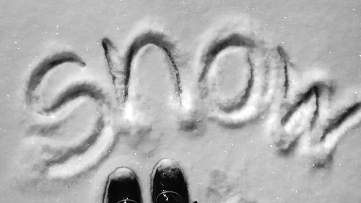
Winter finally made an appearance there this week, dumping actual accumulating snow on the five boroughs and more than a half-foot elsewhere, and if you weren't satisfied with the totals we've got good news.
There's an encore.
Get Tri-state area news and weather forecasts to your inbox. Sign up for NBC New York newsletters.
Granted, it's still a bit early, but we're eyeing the chance for another storm system on Friday. That one continues to be worth watching, with wind, rain and snow all back in play. Check the latest weather alerts here.
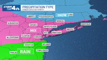
For now, it appears the storm may start out as snow (yes, even in NYC) but it will likely warm up and make the change to rain for the city and spots south. The snow and mixed precipitation will arrive during Friday's P.M. commute, around 5 or 6 p.m., with the worst weather coming during the evening and into the overnight hours.
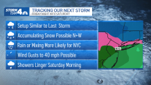
This system is a bit more complicated for those in northwest New Jersey, the Hudson Valley and Connecticut. Along with snowfall, there are indications of a significant sleet accumulation in these areas, with accumulating ice also a big concern for our far northwest counties like Pike in Pennsylvania and Sullivan in New York.
This side of the storm won't really manifest until late Friday into early Saturday, based on current models. It will likely have moved on by sunrise on Saturday.
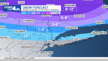
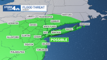
It's too early to predict how much snow we might see from that system, but accumulation is more likely north and west of the city. Some flooding is also possible because of the combination of heavy rain and snowmelt. There's an inch to 2 inches of liquid locked up in some of the current snowpack out there, and another 1 to 2 inches expected Friday.
There's a good chance that because of the rain and sleet that will follow any snowflakes, accumulations will be minimal throughout the region.
Things could change, of course, so stay with Storm Team 4 for all the latest forecast developments, though it doesn't appear we have to worry about schools yet.
The Monday night-into-Tuesday storm led to dozens of school closures and delayed openings across the New York area. Check the latest closings here (and bookmark that URL for easy visiting the next time).
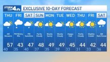
We're looking at a warming trend ahead of the upcoming weather system, with temperatures expected to climb back near 60 degrees on Thursday before highs plunge by double digits once again Friday. We could see some showers associated with a cold front early Thursday, but that should mostly be done by the time the morning rush ends.
The weekend looks like a mixed bag at this point, with temperatures in the mid-to-high 40s and morning showers possible Saturday. Sunday looks to be the better day, with mostly sunny skies and highs around 45 degrees.
Next week looks cool and quiet. And for those wondering, we spring forward on March 12. Sign up for our newsletters here.
More News

Track any approaching precipitation using our interactive radar below.
