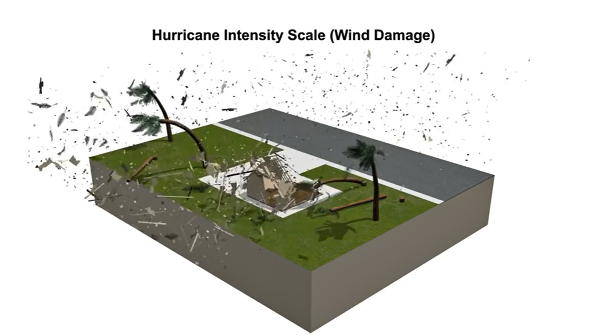
A still-powerful Ian intensified to hurricane status once again Thursday evening, churning northeast as it continues to head toward the Carolinas as a Category 1 storm after tearing off roofs, trapping people in flooded homes and knocking out power to more than 2.5 million in Florida.
The storm made landfall Wednesday afternoon as the fifth-strongest hurricane to ever do so in the United States, based on wind speeds. The monster storm, which has tropical-storm-force winds extending a whopping 415 miles from its center, is expected to maintain its strength as a hurricane before making landfall in South Carolina Friday afternoon.
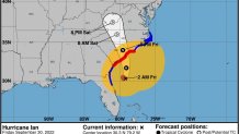
The storm was moving north-northeast and sitting about 175 miles south of Charleston as its maximum sustained winds picked up to 85 mph as of the National Hurricane Center's 2 a.m. update. Life-threatening flooding, storm surge and strong winds are expected for the Carolinas, but the impacts will also hit Georgia and even parts of Florida (once again), which is grappling with catastrophic aftermath — and will be for some time.
On the current track, Ian will continue to intensify moderately as it turns to the north-northwest and approaches the coast of South Carolina Friday afternoon. It's possible the storm strengthens to Category 2 before making landfall. Its center will move farther inland across the Carolinas Friday night into Saturday. While North Carolina is being urged to monitor the system, NHC says Ian is expected to weaken rapidly after making its second landfall in a number of days at hurricane strength.
Get Tri-state area news and weather forecasts to your inbox. Sign up for NBC New York newsletters.
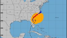
Hurricane warnings are in effect along the eastern seaboard from the Georgia-South Carolina border up to Cape Fear, North Carolina. Storm surge watches and warnings are also in effect, and tropical storm warnings are in place for the rest of the North Carolina shoreline, as well as the coast of Georgia and northwestern Florida.
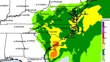
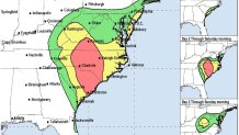
In terms of rainfall, South Carolina's Pee Dee region (the northeastern part of the state) should see the most, 4 to 8 inches with up to a foot possible in isolated areas. The rest of the state, North Carolina and southern Virginia are forecast to see 3 to 6 inches with locally higher amounts of 8 inches possible for western North Carolina. Considerable flash flooding is expected across coastal areas in the high-impact zones through Friday as the tornado threat that afflicted Florida a day ago shifts north.
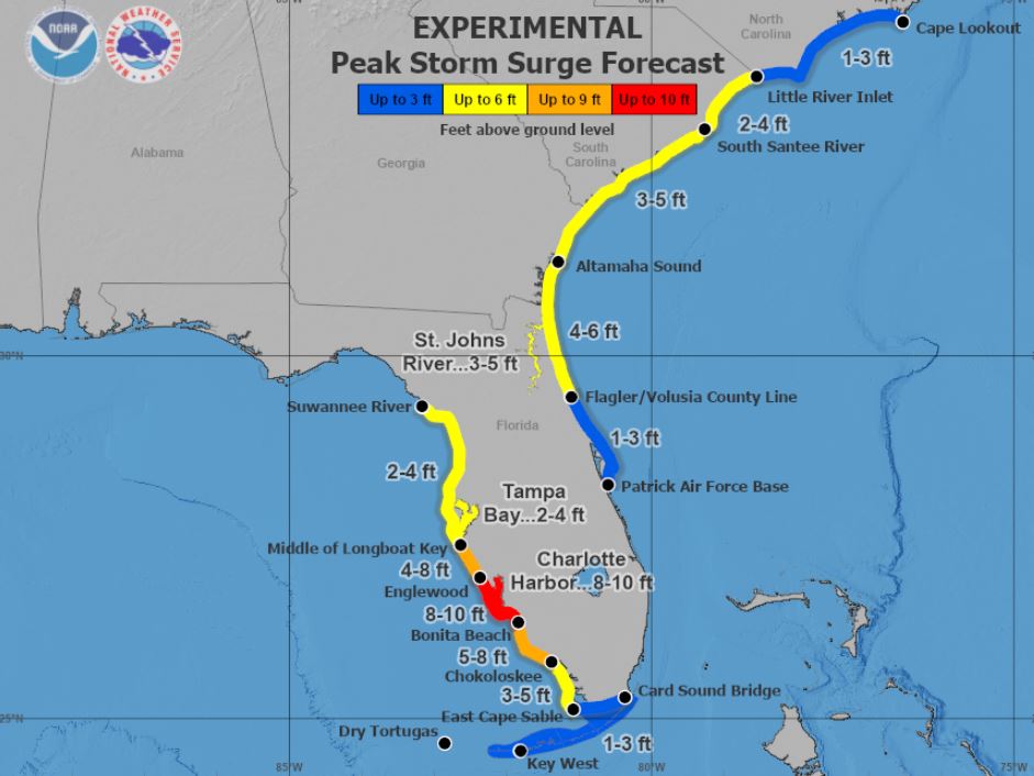
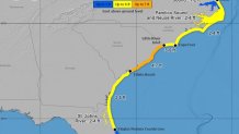
Storm surge and flooding, while not as severe as parts of Florida endured, will be extensively problematic for coastal areas in the warning zone through the weekend. Much of South Carolina could see up to seven feet of storm surge. Georgia, South Carolina, North Carolina and Virginia have declared states of emergency ahead of Ian's arrival.
Major-to-record river flooding, meanwhile, is expected to continue across central Florida through next week. East central to northeast Florida could see up to 20 inches in spots by the time the storm fully pulls away. That's the lower end.
A large portion of central Florida, stretching from Tampa east to Orlando and almost up to Jacksonville was in line to get 10-15 inches of rain during the days-long onslaught from Ian, with some areas on the eastern shore potentially getting deluged with 20 inches or more. Locally, up to 30 inches are possible.
Combine that with storm surges up to 10 feet in some cases, as it was for the coastal area around Fort Myers, and it made for more than enough water to inundate low-lying coastal communities. The damage was seen in videos from multiple areas where roads turned into rivers, with cars bobbing in the water and other items floating away.
No block was left untouched in downtown Fort Myers, with homes shredded by the wind or blown apart by the storm surge — scenes of devastation in every direction. Wally Hanna, a Long Island native, said he escaped the floodwaters by climbing onto the roof of his van, and watched helplessly as his neighborhood went underwater.
"It was a disaster from the devil. I can’t even say it any worse than that," Hanna told NBC New York. "I’ve never seen anything like it in my entire life. And I’ve went through five hurricanes in my lifetime but I’ve never seen like this in my life.”
In Port Charlotte, along Florida's Gulf Coast, the storm surge flooded a lower-level emergency room in a hospital even as fierce winds ripped away part of the roof from its intensive care unit, according to a doctor who works there.
Rainfall Potential
Flash Flood Risk
Peak Storm Surge Forecast
Hurricane Ian Causes Power Outages Throughout Florida
As Hurricane Ian makes landfall in Florida, power outages are expected to grow across the state. The Category 4 hurricane has brought catastrophic winds and flooding to the state.
Source: PowerOutage.us
Credit: Andrew Williams / NBC