
What to Know
- A cold front that brought isolated thunderstorms continues to batter the region with on and off showers all day on Thursday
- The showers are expected to move out by Friday but cooler temperatures will linger; temps should stay in the low-to-mid 60s through Saturday
- The mercury rebounds a bit early next week, to around 70 Monday, though Storm Team 4 says there's a chance for showers as well
Don't stand too close to the streets Thursday if you don't want to get splattered with dirty rain water, Storm Team 4 says.
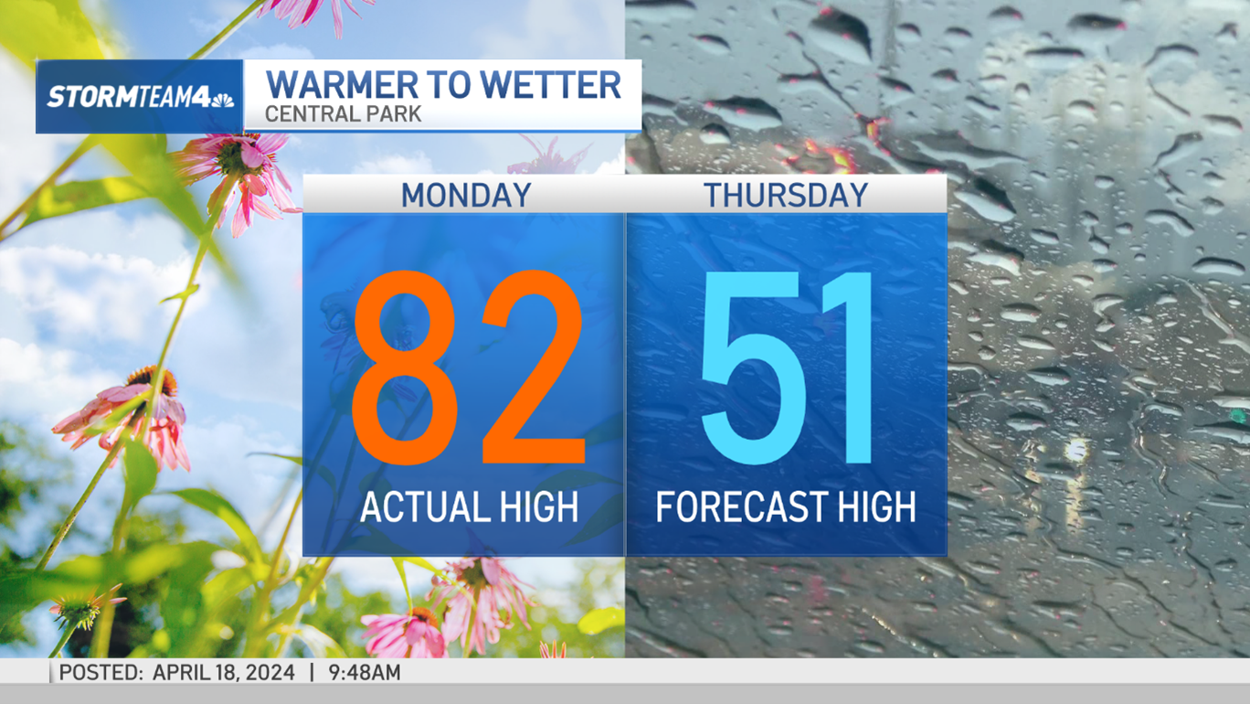
After the tri-state broke some long-standing record temperatures on Wednesday, a cold front that brought isolated thunderstorms continues to batter the region with on-and-off showers all day Thursday. Temperatures plunged nearly 30 degrees, dropping to just the high 50s in the city.
The showers are expected to move out by Friday but cooler temperatures will linger, with Storm Team 4 expecting the mercury to cap out in the low-to-mid 60s Friday and Saturday before rebounding slightly to close out the weekend.
The colder air is a welcome respite for many who saw sweltering temperatures Wednesday. Central Park hit 92 degrees, marking its hottest Oct. 2 on record, and the hottest October day since 1941, according to Storm Team 4. Area temperatures reached 94 degrees on Oct. 5 of that year.
It did not break the overall record for highest recorded fall temperature in the city, which was set in 1927.
Many other areas across the tri-state also broke daily temperature records, as the thermometer hit 95 degrees in Newark and 91 at LaGuardia.
Local

Concerned about your commute home? You can always stay on top of your ride with info from all your key transit sources below (remember to scroll down).
